Most stops on the Heritage Crossroads Highway ask for your wallet. Fort Matanzas asks only for your morning. The entire visit - ferry, fort, trail, beach - costs nothing, which makes it the only free National Park Service fort on this 98-mile A1A corridor. What the site returns is considerable: a working Spanish watchtower built from shell-stone in 1742, a coastal ecosystem sheltering one of Florida's rarest mammals, and a place-name carrying the weight of a 16th-century massacre. Most visitor guides give it three paragraphs and move on. This guide gives you everything you need to plan the stop correctly - starting with the ferry timing strategy that determines whether your visit works at all.
Getting There and Parking
The visitor center sits on A1A South, about 14 miles south of downtown St. Augustine - well within the northern reach of the Heritage Crossroads corridor. Road-trippers heading south from St. Augustine will see the NPS brown signs on the right side of A1A shortly after crossing over Matanzas Inlet. Northbound travelers coming up from Flagler County pass it after Marineland and Washington Oaks Gardens.
Two parking areas serve the site. The river-side lot, directly adjacent to the visitor center and ferry dock, fills first on busy days. The ocean-side lot sits across A1A and gives direct access to the beach and the Coastal Hammock Trail. On crowded spring weekends, both lots can fill before mid-morning. Arrive early or expect to use the grass shoulder and walk. There is no overflow facility and no shuttle.
The visitor center is open daily except Thanksgiving and Christmas. The ferry pass desk opens at the same time as the building - and that opening moment is the critical time anchor for everything that follows.
Ferry Logistics - The Most Important Thing to Know Before You Go
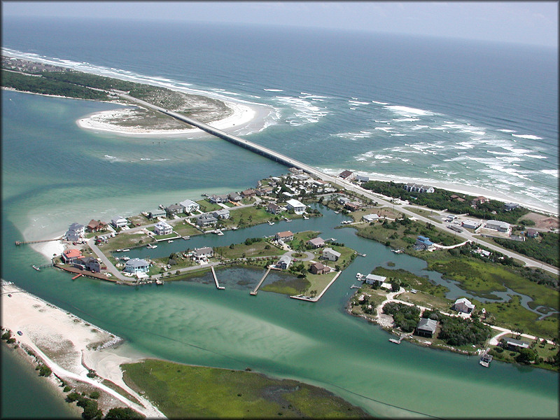
Fort Matanzas sits on Rattlesnake Island inside Matanzas Inlet, reachable only by the NPS ferry from the visitor center. No bridge connects the island. The ferry is free. It departs multiple times throughout the day, with the first crossing in the morning and the last in mid-afternoon. Verify the current schedule at nps.gov/foma before you leave home, because departure times are subject to seasonal revision.
The ferry carries a strictly limited number of passengers per trip. Passes are issued first-come, first-served at the visitor center desk on the morning of your visit. There is no online reservation system and no phone booking. On busy spring and fall days, passes sell out well before noon. Arriving mid-morning on a weekend in March expecting a walk-on is a real mistake.
This is the sequence that actually works on a busy day:
- Arrive at the visitor center before it opens - aim for 8:45 a.m. or earlier on weekends and holidays, since the pass desk opens with the building.
- Go directly to the visitor center desk and ask for ferry passes for your group; confirm your assigned departure time and write it down.
- Use the wait between pass issuance and departure to walk the indoor exhibits, which cover the fort's history and the Matanzas massacre in useful detail.
- Return to the dock a few minutes before your departure time - the ferry will not wait.
- Check the sky before crossing; ask staff about afternoon storm conditions if you plan to be on the island past midday in summer.
If passes are already sold out when you arrive, you have a real alternative: the Coastal Hammock Trail and the ocean beach remain open regardless of ferry status. That section of this guide covers what to do with that time.
The Fort Itself: Architecture, Coquina, and Spain's Defensive Line
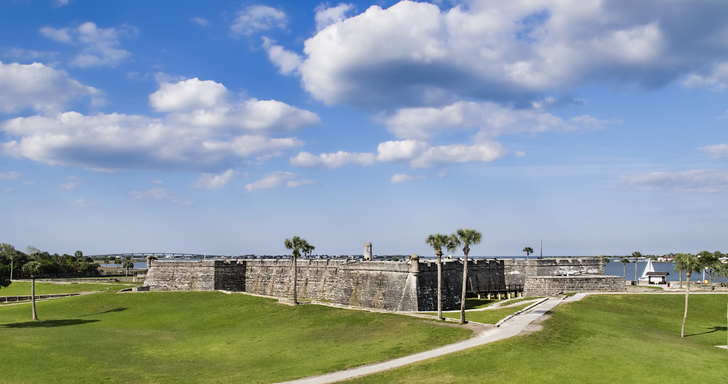
Spanish colonial engineers chose coquina stone for this watchtower for the same reason they used it at the Castillo de San Marcos in St. Augustine: the material does not shatter under cannon fire. Coquina is compressed shell fragments and sand, giving it a porous, absorbent structure. When British forces bombarded the Castillo in 1702 and again in 1740, cannonballs lodged in the walls rather than punching through them. A fortification that absorbs artillery is more durable than one that fractures. That same reasoning governed the design at Matanzas.
The coquina for the fort was quarried at the El Piñón site on Anastasia Island, south of the inlet - the same island source that supplied the Castillo. Workers cut the stone in blocks and ferried it across the water to Rattlesnake Island. Construction ran from 1740 to 1742, making this Spain's last military construction project in Florida as British pressure from Georgia tightened around St. Augustine's southern flank.
The watchtower is compact by European military standards but precisely sited. It sits directly above the inlet's navigable channel, placing cannon fire squarely on any ship attempting to pass. The platform height gave garrison soldiers enough visibility to signal toward St. Augustine if a fleet appeared. Inside, the structure holds a powder magazine, storage space, and a garrison room where soldiers lived - sometimes for extended rotations in conditions that were hot, humid, and confined.
The exterior finish was white lime plaster, with the scarp cordons and upper tower sections painted red using Georgia clay mixed into the plaster. That two-color scheme - white walls, red accents - made the fort conspicuous from the water. Visibility was partly the point. An unmistakable defensive position is also a deterrent.
Spain ceded Florida to the United States in 1821. The fort was decommissioned and fell into disuse, largely forgotten for a century. President Calvin Coolidge declared it a national monument on October 15, 1924, beginning the preservation work that keeps it intact today.
The Name 'Matanzas' and the 1565 Massacre
The word is Spanish for 'slaughters.' Every visitor who reads the site's name is already close to its meaning, and the history behind it is one of the most consequential single episodes in Florida's colonial record.
In 1565, France and Spain were competing for the Florida coast. A French Huguenot colony had established Fort Caroline near present-day Jacksonville. Spain viewed the Protestant settlement as both a strategic threat and a religious one. Pedro Menéndez de Avilés, the Spanish adelantado, was dispatched to eliminate it.
Before Menéndez could engage the French militarily, a hurricane intervened. It wrecked the French fleet sent under Jean Ribault to attack the newly founded Spanish settlement at St. Augustine. The soldiers who survived the storm were stranded on the coast to the south, unarmed and without shelter. Menéndez moved to intercept them at this inlet.
The inlet where those soldiers surrendered was thereafter called Matanzas - and the name has held for more than four and a half centuries, outlasting every political boundary that has changed around it.
In two separate encounters - September 29 and October 12, 1565 - Menéndez's forces accepted the surrender of approximately 245 French Huguenot soldiers at this same location. The soldiers were bound, marched behind the dunes, and given a choice: renounce their Protestant faith, or die. They refused to convert. His soldiers executed them. The killings were carried out in groups, systematically, without resistance from captives who had already surrendered their weapons.
These were not battlefield deaths. They were deliberate executions of unarmed prisoners on grounds of religious identity. Menéndez reported the events to the Spanish crown without apparent hesitation. Spain considered the action justified. France protested but took no significant military response.
The fort constructed 177 years later was named for the inlet it guarded. When you cross on the ferry, the channel below you is the same water those men waded through when they surrendered. The NPS visitor center provides thorough historical interpretation of both events. Spend time with it before or after the crossing.
Wildlife and Coastal Habitats
The monument protects several hundred acres of coastal environment across four distinct habitat types:
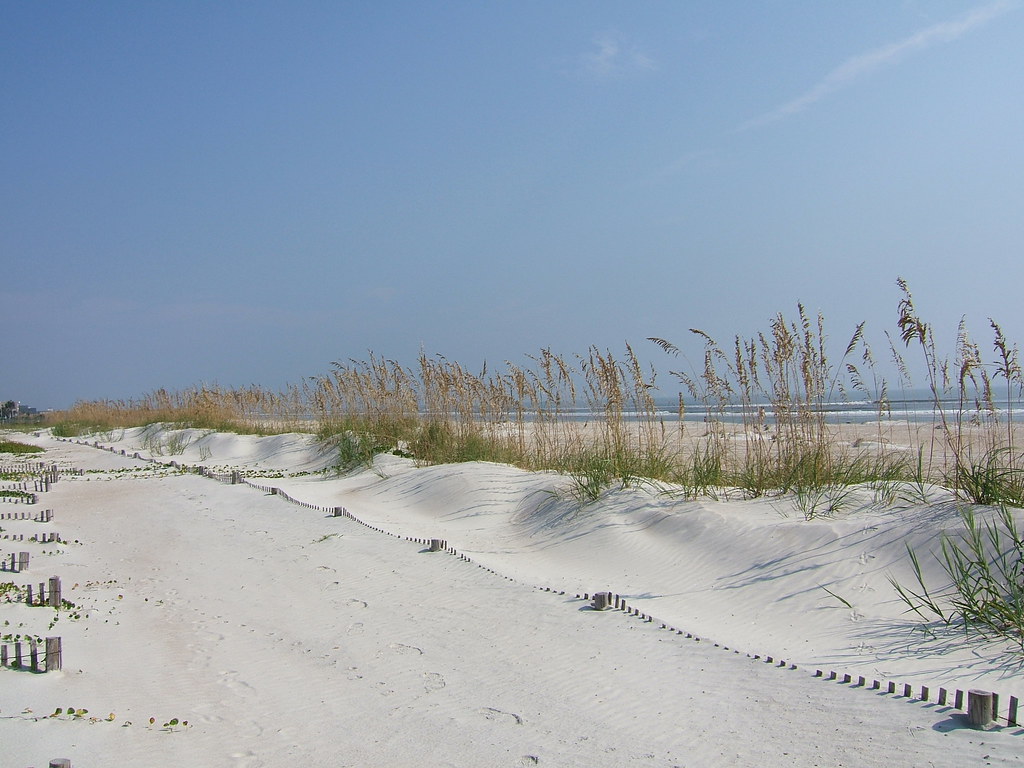
- Barrier-island dunes - primary habitat for the Anastasia Island Beach mouse and nesting shorebirds
- Salt marsh - nursery for juvenile fish, prime feeding ground for wading birds at low tide
- Maritime forest (hammock) - dense shaded interior used by migrating songbirds during spring and fall
- Open water channels - the inlet and Matanzas River, used by dolphins, ospreys, and occasionally sea turtles
The Anastasia Island Beach mouse - Peromyscus polionotus phasma - is federally endangered and almost never mentioned in travel coverage of this site. It is small, nocturnal, and nearly impossible for casual visitors to see. The monument's dune system is one of its only remaining refuges in Florida. The mouse feeds primarily on sea-oat seeds and requires undisturbed sand for burrowing. Coastal development eliminated the vast majority of its historic range over the 20th century. What survives here does so in part because the NPS has kept the dune system intact and off-limits to the kind of foot traffic that collapses burrows and strips seed sources. You almost certainly won't see one. The dunes you walk through are exactly why it still exists at all.
The monument is a designated stop on the Great Florida Birding Trail, with more than 200 species recorded in or migrating through the site. Ospreys fish the inlet year-round from prominent perches. Great blue herons, tricolored herons, and white ibis work the salt marsh edges when the tide drops. During spring and fall migration, the hammock draws warblers moving along the coast. Dolphins appear frequently in the Matanzas River and are often visible from the ferry deck and from the riverbank near the visitor center. Loggerhead sea turtles are occasionally spotted from the ocean beach during nesting season.
The Coastal Hammock Trail and Ocean Beach
If the ferry is full when you arrive, this is your alternative - not a consolation prize. The Coastal Hammock Trail runs from the visitor center through maritime forest to the Atlantic beach. The path is flat and well-maintained, shaded through most of its length by a canopy of live oaks and cabbage palms.
Along the way, watch for:
- Golden-silk orb-weaver spiders - large, vividly colored spiders that string webs at face height between branches; harmless and striking enough that most visitors stop to look
- Spanish moss and saw palmetto - the dense understory that typifies Florida maritime hammock and provides cover for ground-nesting birds
- Interpretive signs covering dune formation, plant communities, and the species that depend on coastal habitat - worth reading slowly
- The dune transition zone - where the shaded hammock gives way to open sand, one of the clearest habitat-edge illustrations you'll find on any Florida trail
The trail ends at a stretch of Atlantic beach that sees a fraction of the foot traffic of the public beaches north and south. You can walk along the shore, wade, or simply sit. Stay on the marked access paths and off the dune face - the habitat management that keeps the beach mouse alive depends on people not cutting through the dune vegetation. The trail works just as well as a complement to the ferry visit as it does a replacement for it. After returning from the fort, walk the hammock on the way back to the car.
Best Times to Visit and Seasonal Tips
| Season | Crowd Level | Ferry Pass Risk | Bird Activity | Sea Turtle Activity |
|---|---|---|---|---|
| Spring (Mar-May) | High | High - arrive before opening | Peak northbound migration | Low; nesting begins late May |
| Summer (Jun-Aug) | Moderate | Moderate; afternoon storms cancel ferry | Lower variety, resident species | Peak nesting and hatchlings |
| Fall (Sep-Nov) | Moderate | Lower than spring; second wave | Strong southbound migration | Late nesting; hatchlings through Oct |
| Winter (Dec-Feb) | Low | Low - passes rarely sell out | Wintering waterfowl and raptors | None |
Spring is the busiest period, driven by spring-break travel and peak northbound bird migration. If you plan a spring visit, treat the ferry pass situation as a hard logistical constraint and build your entire day around the building's opening time.
Summer brings Florida's daily afternoon thunderstorm cycle. The ferry cancels during lightning, sometimes with little warning. Morning visits are safer. Summer is also loggerhead sea turtle nesting season - scan the beach in early morning for nesting crawls and give any staked nests a wide berth.
Fall migration, roughly September through November, brings another strong wave of bird activity with smaller crowds than spring. It is the easier and often better birding season. Winter is the simplest time to get a ferry pass without stress, but the crossing is windier and the salt air is brisk. Bring a layer regardless of what the morning temperature suggests.
Pairing Fort Matanzas with Other Heritage Corridor Stops
Fort Matanzas sits near the St. Johns-Flagler county line, which means a single southbound day of driving can chain it naturally with several other corridor anchors without retracing your route.
- Fort Matanzas - anchor the morning here; secure passes before the building opens, cross to the fort, walk the hammock trail on the return
- Washington Oaks Gardens State Park - about 2 miles south on A1A; the coquina rock garden along the Matanzas River complements the morning at the fort directly, since you'll recognize the same shell-stone material in a different context
- Marineland - a few miles further south; one of Florida's oldest Atlantic-coast attractions, now a marine mammal conservation facility
- Gamble Rogers Memorial State Recreation Area - continues south into Flagler County, offering beach access, river paddling, and camping along the A1A corridor
If you're traveling northbound from Flagler Beach, reverse the sequence and make Fort Matanzas your final stop - but only if you're arriving before noon. An afternoon arrival risks missing the ferry entirely.
The fort also pairs well with the Castillo de San Marcos in St. Augustine as a two-day heritage strategy. The two fortifications are part of the same strategic design: Spain built both to defend the same city from the same British threat, using the same coquina quarry, separated by about 14 miles of coastline and several decades of construction. Seeing both makes the full picture clear in a way that neither site achieves alone.
Frequently Asked Questions
Is there really no charge for the ferry or the fort?
Yes - admission to the monument, the ferry crossing, and all on-site facilities is completely free. This is one of the few NPS sites in Florida with no entrance fee. The visitor center exhibits, the fort tour on the island, the Coastal Hammock Trail, and beach access all fall under the same no-cost umbrella.
What happens if the ferry cancels due to weather mid-visit?
If a storm moves in while you are on the island, the NPS will bring you back as soon as it is safe to operate the vessel. Do not attempt to swim or wade across - the inlet has strong tidal currents. Stay with the group at the fort and wait for the crew's direction. Lightning cancellations are managed by staff, not left to visitors to sort out independently.
Why is the fort named Matanzas if the massacre happened nearly two centuries before it was built?
The inlet itself carried the name long before the fort arrived - it attached to the place within years of the 1565 killings and functioned as a permanent geographic record of what happened there. When Spain chose this inlet for a defensive watchtower in the 1740s, the structure took the name of the water it guarded. The fort's name is not a commemoration of the massacre; it is simply the inlet's name, which was never changed.
Can I visit with children, and is the fort stroller-accessible?
The site is family-friendly, and children are well-served by the exhibits and the ferry crossing itself. The fort on Rattlesnake Island involves uneven stone surfaces and narrow interior passages that are not stroller-friendly. The visitor center grounds and the Coastal Hammock Trail are flat and manageable for most ages. Check nps.gov/foma for current accessibility details before visiting with specific mobility needs.
What is the Anastasia Island Beach mouse and why does it matter?
It is a federally endangered subspecies of the oldfield mouse found almost exclusively on northeast Florida barrier-island dunes, and one of its last surviving populations lives within this monument. Coastal development eliminated most of its historic habitat over the 20th century. The intact, protected dune system here - where it burrows and feeds on sea-oat seeds - is one of the few places where active recovery is possible. You are very unlikely to see one; they are small and strictly nocturnal. But the dunes you walk are not just scenery - they are functioning habitat that conservation management keeps viable.
Is the Coastal Hammock Trail worth doing even if I get onto the ferry?
Yes - the trail covers habitat and biodiversity that the fort visit does not. The transition from shaded maritime forest to open beach dune is a distinct ecological experience, and the orb-weaver spiders alone stop most first-time visitors in their tracks. If your schedule allows, do both: cross to the fort in the morning and walk the hammock trail before you leave. Together they cover the full range of what this monument protects.