Drive the Heritage Crossroads Highway from Flagler Beach to the Tomoka basin and you pass through seven thousand years of human settlement without a single road sign pointing toward it. The corridor's heritage markers tell a story that starts with Spanish explorers and British planters. That story is real, but it starts too late. The Timucua - the people who organized life along these estuaries, river junctions, and barrier island shores for millennia before any European cartographer knew Florida existed - are absent from the traveler's version of this landscape. This guide puts them back.
The Corridor Before the Highway
The 98-mile Heritage Crossroads route threads through Flagler, St. Johns, and Volusia counties, connecting inland pine flatwoods and hardwood hammocks to the estuaries and barrier beaches of A1A. Any Timucua traveler moving through this landscape a thousand years ago would have navigated by the same landmarks: the junction of the Tomoka and Halifax rivers, the oyster beds of Pellicer Creek's estuary, the high ground overlooking the tidal marsh at the corridor's northern reach.
The oldest confirmed human occupation at the Tomoka Mound Complex - the largest archaeological site along the corridor - dates to approximately 5000 BC. That predates the Timucua as a distinct cultural group by thousands of years, but it establishes something important: this corridor has been continuously occupied by indigenous people for at least seven millennia. The Timucua were not the beginning of that story. They were its most recent chapter, and they are the chapter that ended on record, when the last survivors boarded ships for Cuba in 1763.
Who the Timucua Were: Territory, Language, and Social Structure
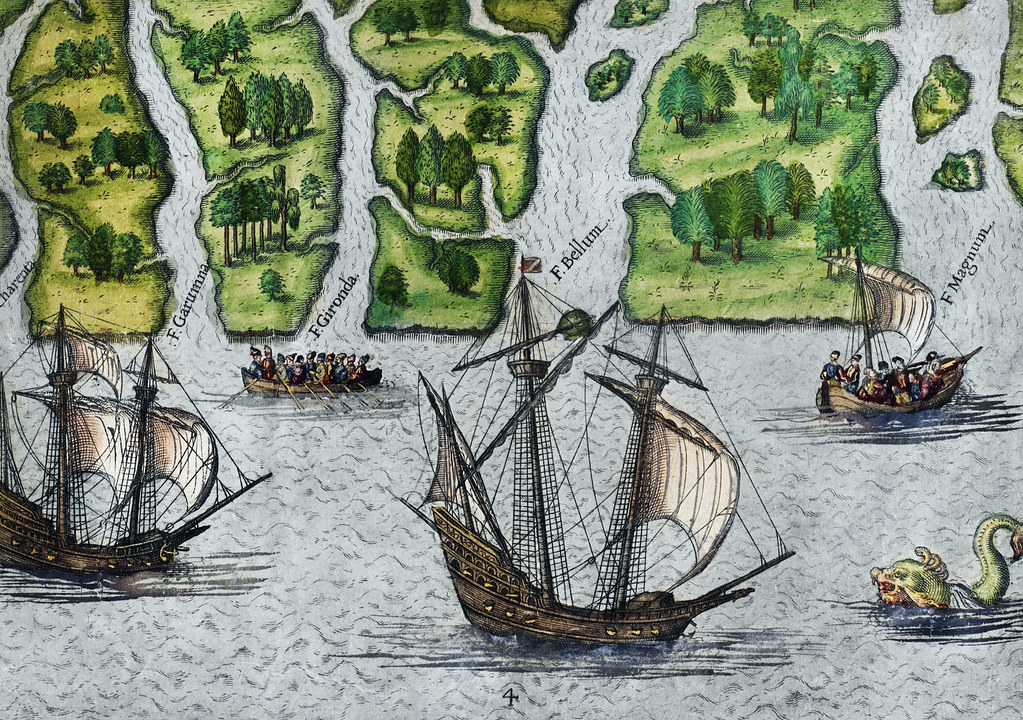
At contact with Spanish explorers in the early 1500s, the Timucua occupied a territory stretching across most of northeast and north-central Florida and into present-day southeastern Georgia. Population estimates at contact typically range from 100,000 to 200,000 people - a range that reflects incomplete early colonial records and significant scholarly variation. The rapid die-off that began almost immediately after sustained European presence pushed this population into steep decline: by 1700, fewer than a thousand Timucua remained.
A Chiefdom Society
Timucua society organized around chiefdoms, each centered on a principal town that controlled surrounding villages. Chiefs inherited status through matrilineal lines. Villages maintained distinct clan identities governing marriage rules, ceremonial roles, and political relationships. When population loss forced two clans into a single community - which happened at the corridor's most important site, Nocoroco - the merger left traces in the pottery record that archaeologists can read centuries later.
Language and Dialects
Timucua is classified as a language isolate - it shows no confirmed relationship to any other known language family. Across their territory, Timucua speakers used around nine to eleven regional dialects, depending on the source. The ones most relevant to the Heritage Crossroads corridor include:
- Mocama - the Atlantic coastal dialect, spoken from around the St. Johns River mouth northward into present-day Georgia, covering the corridor's eastern stretch
- Freshwater (Agua Dulce) - spoken in the interior river country west of the barrier islands
- Potano - the southwestern dialect, spoken in the Gainesville region at the outer edge of Timucua territory
- Acuera - spoken further south, toward the middle St. Johns River valley
These dialects were distinct enough that Spanish Franciscans had to learn individual varieties to do mission work. The linguistic documentation they produced - especially Francisco Pareja's grammars and catechisms printed beginning in 1612 - is among the most complete records of any pre-contact North American language.
The Mocama: Coastal People of the Atlantic Shore
The Timucua group that inhabited what is now the A1A corridor were the Mocama, and their name tells you how they understood their world. Mocama translates as "the sea" or "the ocean." Their territory ran from around the St. Johns River mouth northward into present-day Georgia - the same coastline the Heritage Crossroads route follows through its barrier island sections.
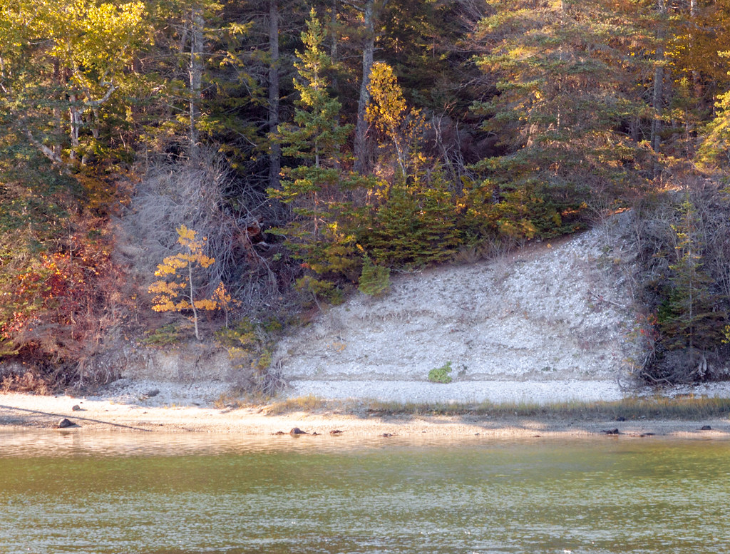
Mocama villages sat on high ground near estuaries, where fresh and salt water mix to create some of the most productive ecological zones on the Atlantic coast. Oysters, clams, mullet, deer, and the yields of cleared garden plots fed these communities. The shell midden at Nocoroco - forty feet of compressed oyster and clam shells accumulated over centuries, still visible along the Tomoka River bank inside Tomoka State Park - is a direct physical record of that diet. The Mocama were also skilled canoe travelers, moving goods and people through the coastal waterway system that today's paddlers use on the same routes.
The Mocama's proximity to St. Augustine, established by Spain in 1565, made them the first large Timucua population the Spanish targeted for conversion and labor extraction. The geography that placed the Mocama at the center of the Timucua world also made them the first to bear the full weight of colonization.
Nocoroco: The Great Village at the Heart of the Corridor
In 1605, Spanish official Alvaro Mexia traveled the Florida Atlantic coast on a reconnaissance mission and recorded what he saw. His account describes Nocoroco as one of the largest Timucua settlements he visited. The village stood at the junction of the Tomoka and Halifax rivers - the precise location now enclosed within Tomoka State Park in Ormond Beach.
The two pottery traditions found at Nocoroco tell a story Mexia did not record. Archaeologists identified two distinct ceramic styles in the same deposit - evidence that two separate Timucua clans had merged into a single community. This consolidation was a survival strategy: when disease and displacement reduced clan populations below the level needed to sustain independent village life, groups folded together. What Mexia observed in 1605 was a large, functioning village that had almost certainly already reorganized in response to losses he had no way to document.
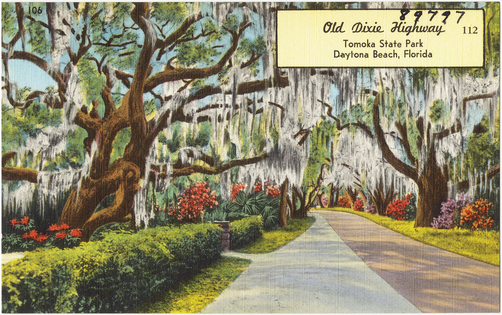
Tomoka State Park today preserves the most accessible Timucua site along the entire corridor. A museum near the entrance provides interpretive context. The Frederick Dana Marsh sculpture of Tomokie, a semi-legendary chief, stands in the park - travelers should understand it as a 20th-century artistic work rather than historical documentation.
The Tomoka Mound Complex: Occupation from 5000 BC to European Contact
Nocoroco was not built on empty ground. Just south of the village site, the Tomoka Mound Complex documents human occupation stretching back to approximately 5000 BC - predating the Timucua by thousands of years, though the Timucua were living there when Europeans arrived. The complex was listed on the National Register of Historic Places on November 27, 2020.
- Ten earthen mounds in total, ranging from low platform ridges to more pronounced burial features
- Four of the ten mounds served mortuary functions, used for interment across multiple generations
- Mound construction peaked during the Thornhill Lake phase, roughly 4,960 to 4,700 calibrated years before present
- Bannerstones - polished stone weights used with spear-throwers - recovered at the site were made from stone types native to north Georgia, several hundred miles north
The Georgia bannerstones deserve particular attention. Moving that raw material from the Appalachian foothills to coastal Florida required maintained exchange relationships across a vast geographic range. The Tomoka site was not isolated. It was a node in a continental network - a fact that rewrites the assumption that Florida's pre-contact peoples lived in contained, local worlds.
First European Eyes: Jacques Le Moyne and the 1564 French Expedition
The French arrived in Florida before Spain established St. Augustine. Rene de Laudonniere led a French Huguenot expedition in 1564, and his party included Jacques Le Moyne de Morgues, an artist tasked with documenting what they found. Le Moyne became the first European to make a visual record of the Timucua. Nearly all of his original drawings are lost. What survived was published in 1591 by Frankfurt engraver Theodor de Bry, who transformed Le Moyne's observations into forty-two engravings that remain, with all their limitations, the primary visual record of Timucua life.
The Le Moyne-de Bry images document a civilization that was large, organized, and deeply adapted to the Florida coastal environment - circular thatched structures capable of holding many families, managed agricultural fields, and a ceremonial life complex enough to require sustained artistic documentation.
Historians treat the engravings carefully. De Bry never visited Florida and introduced European artistic conventions that created distortions. But the core documentation - settlement scale, agricultural practice, material culture - holds up against what archaeology has confirmed at sites like Nocoroco and the Tomoka complex. The images show the world this corridor once contained.
Missions, Epidemics, and Demographic Collapse
The Mission Network
Franciscan missionaries reached Mocama territory within a generation of St. Augustine's founding, and by the early 1600s a chain of missions ran northward along the coast and inland across north Florida. These missions were not simply churches. They were reduccion communities - deliberately compact settlements designed to pull dispersed indigenous populations into controllable villages organized around Spanish priestly authority. The traditional Timucua pattern of dispersed clan villages was replaced by concentrated mission populations that were far more vulnerable to a single epidemic event.
Epidemic Waves
The Franciscans' own records document what followed. They estimated that roughly half of all Christian Timucua converts died in epidemics between 1613 and 1617 - a four-year period that halved the mission population in the same decades the mission network was still expanding. A measles outbreak in 1659 killed an estimated ten thousand people across the Spanish Florida colony. These are documented events recorded by the people managing the mission system, describing the destruction of the population they were supposed to be governing.
By 1700, the Timucua who had numbered somewhere between 100,000 and 200,000 at contact had fallen below a thousand. Every Spanish colonial landmark along the Heritage Crossroads corridor exists within a landscape that was simultaneously losing its primary human population at a rate without precedent in the region's history.
The Final Destruction: English Raids and Extinction
Disease alone did not end the Timucua. From around 1683 through 1708, English-allied Creek and Yamassee war parties from Carolina launched a sustained military campaign against Timucua missions in north Florida. These were not isolated raids. They were organized, repeated attacks that killed hundreds, enslaved hundreds more, and drove surviving Timucua into the immediate vicinity of St. Augustine. The attacks burned mission churches and destroyed the concentrated communities the Franciscans had spent a century assembling.
The census record after those raids is unambiguous. By 1726, only 176 Timucua could be identified, though figures vary slightly across historical sources. By 1752, just 26. When Spain transferred Florida to Britain in 1763, the last surviving Timucua - estimated at roughly 125 people at that point, with some sources giving a figure of around 89 for those who specifically departed - chose to leave with the Spanish rather than remain under British rule. They went to Cuba. No self-identified Timucua community survived the colonial transfer. The language, the ecological memory, the body of social knowledge accumulated over thousands of years along this corridor left with those ships and was not preserved in any recoverable form.
Where to Experience Timucua Heritage Along the Corridor Today
Physical sites, interpretive programming, and natural landscapes connected to Timucua history are distributed unevenly along the corridor. Some are marked. Others require visitors to bring their own context. The stops below run roughly south to north.
- Tomoka State Park, Ormond Beach - The essential stop. The park contains the Nocoroco village site, the shell midden along the Tomoka River bank, and access to the Tomoka Mound Complex. Get a trail map at the entrance, ask about ranger-led archaeology programs, and walk the riverbank trail before anything else.
- Florida Agricultural Museum, Palm Coast - The only site within Flagler County offering on-site Timucua interpretation. The museum incorporates indigenous history into its programming. Check the museum's website for current schedule before visiting, as programming availability may change.
- Pellicer Creek Watershed, Flagler County - The creek flows through documented Mocama archaeological territory and is primarily accessed as a paddling resource. Ask outfitters about the archaeological history of the watershed before you launch; the creek's indigenous context runs directly through the corridor's paddling narrative.
- Guana Tolomato Matanzas Research Reserve - At the corridor's northern end, the reserve encompasses former Mocama territory near the St. Johns River mouth. The visitor center provides natural and cultural history interpretation; contact the reserve directly for current programming on indigenous history.
| Site | Type of Evidence | Interpretation On-Site | Best Access |
|---|---|---|---|
| Tomoka State Park | Shell midden, 10 mounds, village site | Yes - museum and walking trail | Walking trail from park entrance |
| Florida Agricultural Museum | Cultural programming, no in-ground remains | Yes - scheduled programs | Drive-in; check calendar first |
| Pellicer Creek Watershed | Documented subsurface sites, Mocama territory | Minimal - context requires prior research | Paddle or waterfront access |
| GTM Research Reserve | Former Mocama coastal territory | Yes - visitor center | Reserve trails and visitor center |
| Black Hammock Island area | Pottery dated to at least 2500 BC - among oldest in US | Research context only | Background reading, not a public stop |
The Trail of Florida's Indian Heritage designation applies to the broader regional route and provides additional framing for the corridor as a whole. The Florida Department of State maintains current information on heritage trail programming and site accessibility - check there before planning a multi-stop visit, as public access to specific archaeological features can change.
Frequently Asked Questions
Did the Mocama Timucua actually live along what is now A1A?
Yes. The Mocama dialect group's territory covered the Atlantic coastline from around the St. Johns River mouth northward into present-day Georgia - the same stretch A1A follows through the corridor. Their villages clustered near estuaries and high ground overlooking the coastal waterway. Nocoroco, at the Tomoka-Halifax river junction, is the best-documented village site directly along this route.
What is the most tangible thing visitors can see at Tomoka State Park?
The shell midden along the Tomoka River bank is the most immediate physical evidence - a large elevated deposit of oyster and clam shells representing centuries of Mocama daily life, visible from the park's walking trail. The park museum adds interpretive context, and the entry fee is the main cost; confirm the current fee at the park entrance or through the Florida State Parks website, as it can change.
Are there any Timucua descendants today?
No confirmed Timucua-descended community exists. The last identifiable Timucua population departed for Cuba in 1763 with the Spanish colonists, and no self-identified community maintained continuity through the British period. There is no recognized tribe or documented lineage carrying forward the pre-contact Timucua cultural tradition.
Why does the Tomoka Mound Complex matter if it predates the Timucua?
The mound complex shows that the Timucua inherited a landscape already shaped by thousands of years of indigenous occupation and long-distance exchange - the Georgia bannerstones found at the site prove this corridor was embedded in continental trade networks long before the Timucua arrived. The Timucua used and lived near these mounds, making the complex part of their landscape too, not a separate chapter.
Why are the English-allied Creek raids of 1683-1708 so rarely mentioned in heritage content about this corridor?
Most corridor interpretation focuses on the Spanish colonial and British plantation periods that came before and after - the Creek and Yamassee raids fall in a gap between the mission era and the plantation era that traveler-facing heritage content tends to skip. But those raids were the direct mechanism that destroyed the mission system and drove the surviving Timucua into St. Augustine, so leaving them out makes the population collapse seem like something that simply happened rather than something that was done.