Most stops along the Heritage Crossroads corridor ask you to imagine what was there. Bulow Plantation Ruins shows you. Three miles west of Flagler Beach on Old Kings Road - the same colonial road that connected East Florida's plantations to St. Augustine and points north - the coquina walls of a sugar mill rise out of live oak canopy without explanation or architectural context. There is no reconstructed building around them, no museum to soften the encounter. What stands is what survived a deliberate fire in January 1836. Understanding why those walls are still standing, while every other structure at Bulowville is gone, is the first interpretive key to the whole site.
The Bulow Family and the Making of East Florida's Largest Plantation
In 1821, the same year Spain ceded Florida to the United States, Major Charles Wilhelm Bulow purchased 4,675 acres of tidal creek land in what is now Flagler County. He moved fast. Within a few years, 2,200 acres had been cleared for cultivation - a scale that made the Bulow operation the largest plantation in East Florida. He was not running a single-crop farm. Sugarcane, cotton, rice, and indigo grew simultaneously across the cleared acreage, and by 1831, when the sugar mill was completed, it had become the commercial center of everything.
Charles Wilhelm Bulow died in 1823, just two years after the purchase. His 17-year-old son John Joachim Bulow inherited the estate, completed his education in Paris - a detail that signals the family's ambitions - then returned to manage a labor force and landholding that would have been extraordinary for a much older man. He became one of territorial Florida's wealthiest young landowners. That wealth rested entirely on the labor of between 300 and 400 enslaved African Americans, housed in 46 cabins arranged in a semi-circle around the main house. Processing sugarcane in subtropical heat, before mechanical cooling, was among the most physically brutal agricultural work in North America.
Enslaved Lives at Bulowville
The people who built Bulowville and kept it running are the hardest part of its history to recover. Plantation records in Florida were sparse and are mostly lost. What the site itself reveals, though, is significant.
The semi-circular cabin arrangement meant the enslaved community of up to 400 people was both geographically central to daily plantation operations and continuously visible from the main house. The earthen outlines of those cabin foundations are still traceable on the ruins trail today - low ridges in the ground that most visitors walk past without recognizing them for what they are. They are the only physical trace of the people whose labor made the sugar mill function.
That sugar mill is partly their construction. Coquina - the compressed shell limestone used for the walls - had to be quarried from coastal deposits, transported inland, and laid by hand. Moving enough of it to build a functioning mill complex required sustained, organized labor over a long period. The masonry skill embedded in walls that have survived nearly two centuries belongs to the people who were enslaved here.
A Famous Guest: John James Audubon at Christmas 1831
On Christmas Day 1831, John James Audubon arrived at Bulowville having walked roughly 12 to 15 miles south from the Hernandez plantation (known as Mala Compra, near present-day Palm Coast). He was traveling the Florida coast collecting specimens for what would become 'The Birds of America,' and Bulowville - with its hammock forest, tidal marsh, and creek access to Atlantic coast estuaries - was exactly the base camp he needed. He stayed approximately six weeks, launching collecting expeditions into the surrounding landscape of old-growth hammock, coastal scrub, and grassy tidal flat.
One painting from this stay stands out for reasons beyond ornithology. Audubon's depiction of the Greater Yellowlegs, published in 'The Birds of America,' shows Bulow Plantation buildings rendered in the background. That background was not decorative filler. It is one of the only surviving visual records of what Bulowville looked like before the fire of 1836 destroyed every wooden structure. The buildings Audubon painted as incidental background detail are gone; the painting is not - which makes it an irreplaceable piece of documentary history that most visitors to the ruins never know exists.
The Greater Yellowlegs painting in 'The Birds of America' is not just a bird study. It is the only known pre-fire image of Bulowville - a record of buildings that no longer stand, preserved because a naturalist needed a background for his subject.
Seminole Neighbors, War, and the Burning of Bulowville
Before the Second Seminole War shattered the existing order in East Florida, Bulowville functioned as a trading post as much as a plantation. Seminole leaders - including King Philip (Emathla), his son Wild Cat (Coacoochee), and Billy Bowlegs - were regular trading partners there. The exchange was practical on both sides:
- Seminole traders brought venison, wild hogs, and coontie flour
- Bulow supplied cloth, salt, rum, and silver dollars
- These were not incidental visits - they were a functioning commercial relationship maintained over years
When U.S. Army troops under Major Benjamin Putnam arrived at Bulowville intending to use it as a staging ground for Seminole removal operations, John Bulow refused to cooperate and went further than refusing - he fired on the troops. He was arrested. The plantation was converted into a militia outpost, which made it a military target in an active war.
Seminole warriors burned Bulowville on approximately January 11, 1836. John Bulow evacuated along Old Kings Road with wounded soldiers and refugees before the fire reached the buildings. He died within months, not yet 30 years old. The plantation was never rebuilt. The State of Florida acquired the ruins in 1945 and formally dedicated the site as a State Historic Park in 1957.
The personal arc of John Bulow - inheritor at 17, Paris-educated, one of the territory's wealthiest men, then rebel against U.S. military authority, then refugee, dead before his 30th birthday - almost never gets told in full in existing guides to this site. It is the story the ruins are telling.
What the Coquina Tells Us: Reading the Ruins
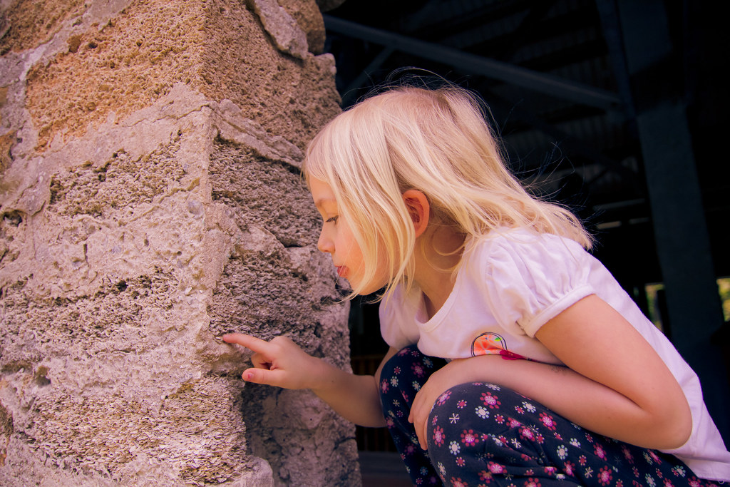
Coquina is a sedimentary limestone formed from compressed coquina clam shells. It is porous enough to absorb impact - Spanish colonial builders in St. Augustine found that British cannonballs bounced off coquina fort walls rather than shattering them - and it does not combust. When the fire of January 1836 consumed every wooden structure at Bulowville, the coquina mill walls absorbed the heat without burning. The fire had nothing to work with.
Wood rots, burns, and disappears within decades. Coquina, quarried from coastal deposits and laid by hand, lasts centuries. The ruins at Bulow are a lesson in what survives when everything combustible is gone - and a reminder that the choice of building material was not incidental. Coquina was the most durable option available, which is why it was used for the plantation's commercial heart.
What You Will See on the Half-Mile Loop
The self-guided ruins trail covers the main complex in sequence. Walking it in order gives the clearest read of how the plantation functioned:
- Sugar mill walls and chimney - the largest standing structures; the chimney served the grinding equipment that processed harvested cane
- Engine house - the separate structure that housed the mill's power source; partial walls survive
- Spring house - fed by a natural spring and used to keep perishables cool; one of the more intact smaller structures
- Hand-dug wells - multiple wells served different sections of the compound; stone linings are visible at ground level
- Slave cabin foundations - low earthen ridges marking where 46 cabins stood in a semi-circle; the least visually dramatic feature on the trail and the most historically significant
Planning Your Visit: Hours, Directions, and Seasonal Tips
The park is open Thursday through Monday and closed Tuesday and Wednesday - a detail that catches many visitors by surprise, since Bulow appears in weekend-trip roundups without the mid-week closure being flagged. A vehicle entry fee applies; check the Florida State Parks website for current hours and rates before you make the drive. The park lies on Old Kings Road approximately three miles west of Flagler Beach. From Flagler Beach, head west on State Road 100, then turn south. From Bunnell, Old Kings Road runs south directly to the entrance. No meaningful transit access exists; this stop requires a car or bicycle.
- Fall through spring is the most comfortable window - lower humidity, fewer insects, and better wildlife visibility on the water
- Summer is workable if you are on the ruins trail by 8 a.m. and on the water before the afternoon heat sets in; mosquito pressure from July through September is genuine
- Winter brings the lowest crowds and the best shorebird activity along the creek - the salt marsh habitat hosts wintering species absent in warmer months
- Bring water, insect repellent, and closed shoes for the ruins trail; cell coverage on the water is inconsistent, so download a trail map before you arrive
On the Water: The Bulow Creek Paddling Trail
The Bulow Creek Designated Paddling Trail runs 6.5 miles one-way from the park's boat ramp downstream through tidal marsh to the Intracoastal Waterway at North Peninsula State Park. It is rated easy to moderate, but the key variable is tidal influence. Bulow Creek is tidal, and the current can be strong enough in the narrower upper sections to require real effort against it. Check the tide chart for Flagler Beach before you launch. Paddling with the outgoing tide is the preferred approach, and arranging a car shuttle at North Peninsula State Park makes the trip genuinely one-way rather than a hard out-and-back against the returning flood.
The upper section near the boat ramp moves through narrow creek lined with marsh grass and overhanging canopy - shaded and productive for birds. Downstream, the creek opens into broader tidal flat country. Egrets, herons, ospreys, and roseate spoonbills work this corridor regularly; in winter, shorebirds and ducks use the exposed flats at low tide. Dolphin appear frequently in the lower sections near the Intracoastal junction, and manatees are present in warmer months. Rental kayaks are not available at the park itself - bring your own or arrange a rental from an outfitter in Flagler Beach before arriving.
Combining Bulow with the Heritage Crossroads Corridor
Bulow's position on the Old Kings Road segment makes it a natural anchor for a day trip covering two or three sites without backtracking.
| Site | From Bulow | Best Timing | What It Adds |
|---|---|---|---|
| Princess Place Preserve | Approx. 12 miles north | Morning, before Bulow | Florida's oldest intact hunting lodge; hammock and creek trails |
| Florida Agricultural Museum | Nearby on Old Kings Road | Afternoon, after ruins | Working heritage farm; contextualizes Bulow's agricultural scale |
| Old Brick Road at Espanola | Short drive north | Late afternoon drive | Surviving original brick - the road Bulow evacuated along in 1836 |
| Bulow Creek Paddling Trail | On site | After morning ruins visit | Tidal marsh, wildlife, waterway the plantation used for transport |
A full-day itinerary that works well: arrive when the park opens, walk the ruins loop while the light is still low and the heat manageable, then launch on the paddling trail by mid-morning with a shuttle arranged at North Peninsula State Park. If you are skipping the paddle, the Florida Agricultural Museum makes a logical afternoon stop that deepens what you just walked through at the ruins. The Old Brick Road section near Espanola is worth a brief stop on the drive north - it is the same road John Bulow traveled in January 1836, a connection that closes the loop between the ruin and the landscape it once occupied.
Frequently Asked Questions
Is the park open on weekends?
Yes - the park is open Thursday through Monday, which includes both weekend days. It closes on Tuesday and Wednesday. Confirm current hours on the Florida State Parks website before visiting, as holiday schedules can differ.
Why did the sugar mill survive the 1836 fire when everything else burned?
The mill walls were built from coquina, a compressed shell limestone that does not combust. Every wooden structure at Bulowville - the main house, the 46 slave cabins, the outbuildings - burned completely. The coquina walls absorbed the heat and stood. The same material and the same logic explain why the Spanish built St. Augustine's Castillo de San Marcos from coquina rather than wood.
Can I paddle the Bulow Creek trail without arranging a shuttle?
You can, but the 6.5-mile one-way route becomes a 13-mile round trip with tidal current working against you on one leg. If you go without a shuttle, time your launch to paddle out on the ebbing tide and return on the flood - this means turning around well before the full one-way distance, which is still worthwhile for the habitat and wildlife in the upper creek near the launch ramp.
What does the Audubon connection mean for visitors today?
Audubon's Greater Yellowlegs painting from 'The Birds of America' shows Bulow Plantation buildings in the background - one of the only known visual records of the plantation before the 1836 fire destroyed it. The species he documented during his six weeks here, including birds of the salt marsh and hammock habitat around Bulow Creek, still use this corridor. Binoculars and a field guide are genuinely useful on a visit, not just decorative.
Where exactly are the slave cabin foundations on the trail?
The cabin foundations survive as low earthen ridges rather than standing walls - subtle enough that many visitors miss them without knowing to look. They are located in the area where interpretive signage references the enslaved community, near where the semi-circular cabin arrangement surrounded the main house site. Wet conditions after rain make the outlines harder to distinguish; dry weather is better for reading the ground.
Is there anything to do at Bulow if I do not want to paddle or walk the ruins?
The Bulow Woods Trail - a longer route through old-growth oak canopy starting at the Plantation Road parking area - is open to hikers and cyclists and covers different habitat than the ruins loop. It does not require any water gear or special preparation, and the canopy makes it more comfortable than open-ground trails in warmer months. Check the Florida State Parks site for current trail conditions before planning around it.