There is a 3,084-acre freshwater wilderness sitting between Palm Coast's subdivision cul-de-sacs and the Atlantic Ocean, and most people who drive State Road 100 past its edge have no idea it exists. Graham Swamp Conservation Area is not hidden behind a long dirt road or tucked away in a remote county. It is right there, separated from Flagler County neighborhoods by nothing more than a drainage ditch and a fence line, and it remains one of the most overlooked outdoor destinations on the Heritage Crossroads corridor. Two trail systems offer visitors entirely different reasons to stop here - one built for anyone who can walk a flat path, the other ranked among the finest mountain biking terrain in Florida - and the gap between those two experiences tells you something important about how much ground the preserve actually covers.
The Swamp You Drive Past Without Knowing
Palm Coast was planned from scratch around 1970 - ITT Corporation announced its development plans in 1969 and held the city's grand opening in October 1970, pressing a grid of canals and boulevards into raw Florida flatwoods. Graham Swamp survived that development not because anyone protected it early, but because wetland hardwood swamp resists drainage and is expensive to fill. The swamp ended up encircled by the suburban grid rather than consumed by it, and when the St. Johns River Water Management District eventually acquired the land, it became one of the more recent additions to Flagler County's preserve network.
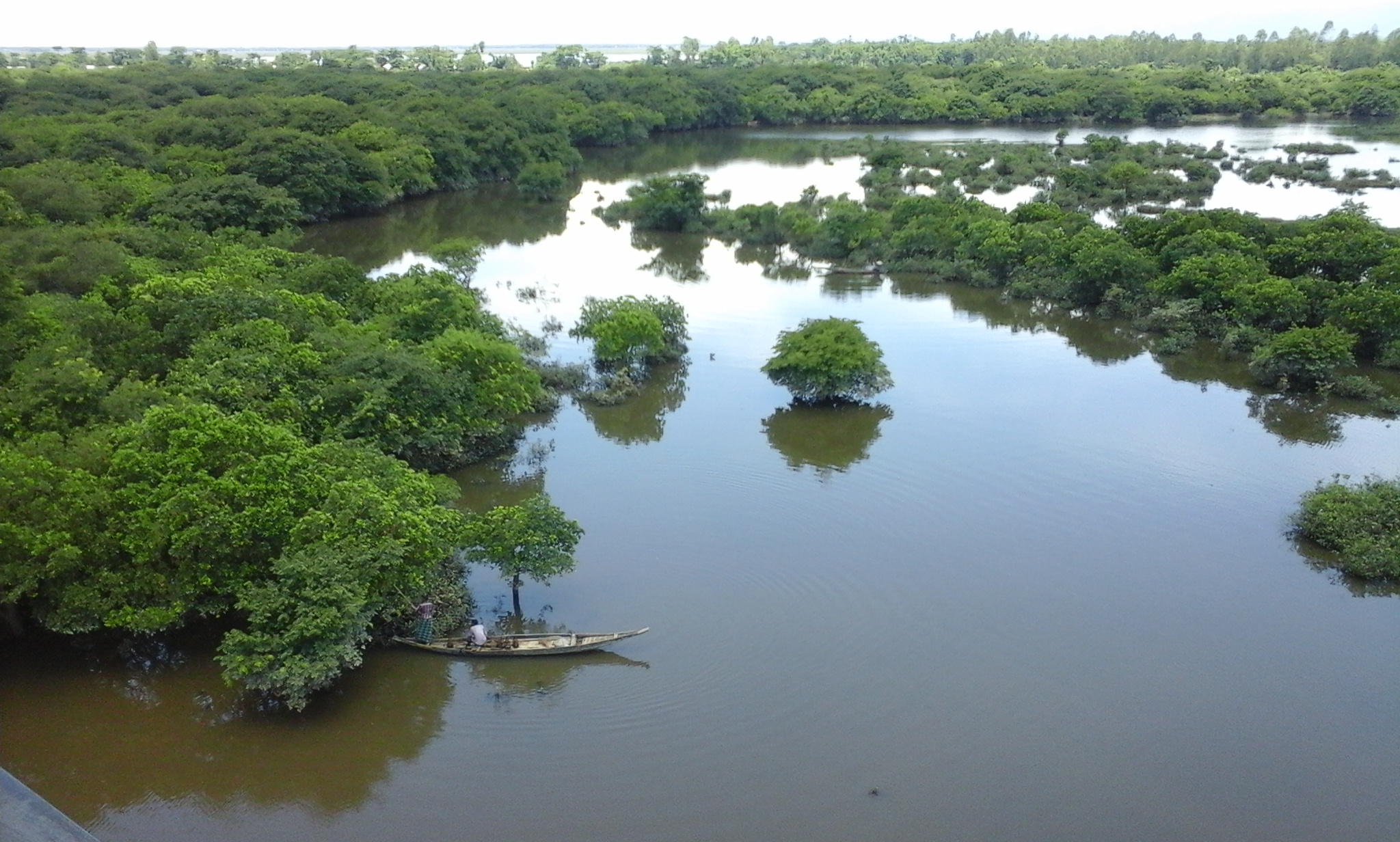
What no planning map conveys is the scale. More than 2,500 of the 3,084 acres are classified as wetland hardwood swamp - standing water under a dense canopy, with an interior that five perimeter access points and several miles of trail only begin to touch. The forested upland islands that rise from the water table cover the rest, but they are largely inaccessible. Walk in from any trailhead and the preserve does not open up the way a pine flatwoods does. It closes around you at the edges and the middle stays wild.
One other fact stops people short: this swamp sits 1.5 miles from the Atlantic Ocean. That is not a misprint. One of the largest contiguous freshwater swamp forests on Florida's east coast exists within walking distance of the beach, separated from the salt environment by a narrow coastal ridge. Understanding why that is - and why the swamp functions the way it does - starts with the ecology.
Ecology of a Coastal Freshwater Swamp
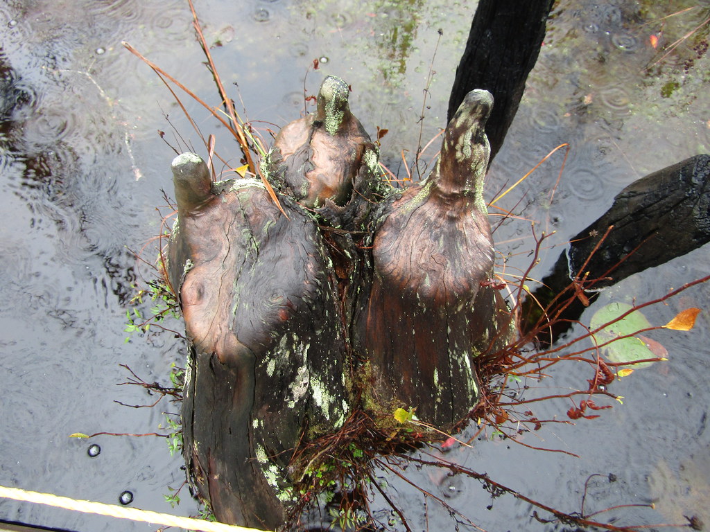
Wetland hardwood swamp in Florida is dominated by water-tolerant species: bald cypress, red maple, swamp bay, pop ash, and Carolina willow form the canopy and subcanopy over much of Graham Swamp's interior. Below them, the water table sits at or above ground level for much of the year, creating conditions that upland species cannot tolerate. The result is a slow-moving, high-canopy ecosystem that looks primeval from the boardwalk and functions as habitat for a dense cross-section of Florida wildlife.
The freshwater-saltwater proximity that seems like a paradox is explained by elevation. The Atlantic coastal ridge - an ancient formation of dune and coquina - acts as a barrier that keeps tidal saltwater from pushing inland. The swamp receives its water from rainfall and upland drainage rather than tidal exchange, which keeps it fresh despite being a short walk from the ocean. This position between two entirely different ecosystems concentrates migratory birds moving along the coast in ways that a swamp set further inland would not.
The preserve also performs a job that its suburban neighbors depend on. Decades of ditching and dike construction built to support Palm Coast's stormwater drainage have altered the swamp's natural hydrology, changing flow patterns that existed long before the subdivisions arrived. Despite that disruption, the swamp still functions as a major stormwater retention and filtration zone. Water that runs off Palm Coast's roads and rooftops moves into the swamp's basin, slows, filters, and eventually returns to the regional water table. The preserve is not just aesthetically convenient for the surrounding neighborhoods - it is structurally necessary to how their drainage system works.
The West Trail: Coquina Path and Boardwalk Over Water
The west trail covers 2.18 miles and runs as a multi-use path ten feet wide - wide enough for two cyclists to pass a walker without anyone stepping aside. The surface is compacted coquina, a locally quarried shell-and-limestone material that drains quickly and holds firm footing after rain. Wheelchair users and stroller pushers can navigate the path without difficulty, and the grade is flat throughout.
The boardwalk sections are what set this trail apart from a standard park path. They extend directly over open swamp water, placing visitors at near-water level rather than on a high viewing platform. Standing there, a great blue heron hunting among cypress knees is at eye level. From the boardwalk you are close enough to the surface to hear the swamp clearly and to notice what most trail visitors never see from the bank. What you actually observe changes by season:
- Bald cypress with flared bases rising from dark, tannin-stained water
- Herons and egrets hunting at eye level along root tangles a few feet from the rail
- River otter wakes crossing the open water in the early morning
- Alligators resting motionless on submerged logs - present year-round, more visible in cooler months when they surface to warm
- Migratory warblers moving through the canopy just above your head in spring and fall
The boardwalk uses PermaTrak precast concrete panels rather than traditional stick-built timber. That choice was deliberate: precast concrete can be assembled with minimal heavy equipment, which matters when you are building over soft wetland soils where a conventional crane would destroy the ground before the first board went down. The west trailhead sits on Old Kings Road, and the path connects to the SR 100 pedestrian bridge, which opens the full circuit to hikers, cyclists, and families moving between the two sides of the preserve.
The East Trail: Florida's Unlikely Mountain Biking Destination
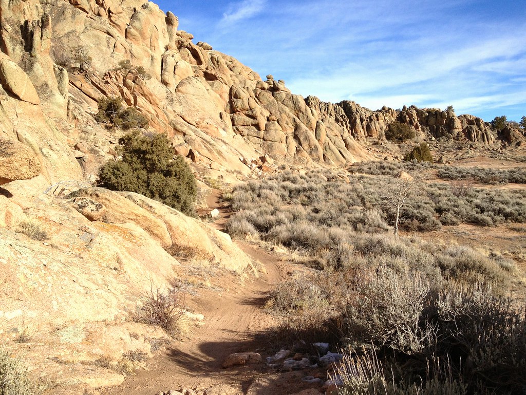
The east trail is a 5.5-mile black diamond loop, and the terrain it uses should not exist in coastal Florida. The preserve sits on a natural coquina and sand ridge - the same Atlantic coastal ridge that separates the swamp from the ocean - and the trail designers recognized that this formation offered something rare in a state where most off-road riding takes place on dead-flat sand: real elevation change, technical surface, and sustained physical challenge.
The loop includes short climbs, steep rocky descents, exposed root systems, and sections of raw coquina that punish riders who brake late or line up wrong. These are not mountain climbs in the Western sense - the ridge measures in tens of feet, not hundreds - but in flat Florida, a four-second descent over broken coquina followed immediately by a tight turn is a genuine test of handling. First-time visitors should expect to walk sections.
SingleTracks.com, the primary reference database for mountain bike trails worldwide, has ranked Graham Swamp among Florida's top mountain biking destinations and among its highly rated trails globally - a standing that reflects consistent rider experience across years of reviews, not a single surge of attention. Check SingleTracks directly for the current rating, since the platform updates continuously as new reviews come in. The trail also hosts organized races that draw competitors from across the region. Local volunteers handle the majority of ongoing maintenance: trimming, drainage work, and post-storm clearance that keeps the loop rideable through Flagler County's wet season. Without that crew, a trail this technical on natural coquina would degrade quickly.
Wildlife and Birding
More than 100 bird species have been documented at Graham Swamp, a count that reflects both the depth of the swamp interior habitat and the preserve's position along the Atlantic flyway. Serious birders work the west trail boardwalk in early morning, when the canopy is active and the water surface shows what moved through the night before.
Year-round residents include bald eagles, osprey, and multiple heron and egret species that nest in the interior canopy. Sandhill cranes work the upland margins near the trailheads. Warbler movement peaks in spring and fall migration, when the freshwater habitat along a coastal corridor concentrates species that would otherwise scatter across a much wider area. Because the swamp is surrounded by suburban development with limited comparable habitat nearby, the preserve functions as an essential stopover point for migrants that have no alternative within the Palm Coast footprint.
Mammal sightings are frequent enough to reward patience. River otters appear regularly on the west trail boardwalk in the early hours. White-tailed deer, armadillos, and feral hogs move through the upland margins. American alligators are documented residents throughout the preserve - treat them as you would any wild alligator, which means maintaining distance and not approaching animals near water. Gopher tortoises use the sandy upland zones near the east trailhead, where the coquina ridge provides suitable burrowing substrate. Their burrows are protected under state wildlife rules and serve as shelter for dozens of other species that share the upland habitat.
The SR 100 Bridge: Infrastructure That Stitched the Preserve Together
Before the pedestrian bridge over State Road 100 was built, the east and west sections of Graham Swamp were functionally separate destinations. A visitor who parked on one side and wanted to cross had to drive back to SR 100 and park again. The bridge changed that.
The span is an A-frame truss structure, and the design was not arbitrary. The engineers and designers consciously echoed the form of the Flagler Beach Pier - the pier that stands a few miles south on the coast - creating a visual connection between two of the corridor's most recognizable structures. For visitors traveling the Heritage Crossroads byway, the bridge is a piece of connective infrastructure that also works as a reference to where they are along the coast. The two structures share a silhouette across several miles of flatwoods and barrier island.
The boardwalk sections throughout this project use the same PermaTrak precast concrete construction applied on the west trail, chosen for the same reason: minimal ground disturbance over soft wetland soils. The project received a 2024 National Recognition Award from the American Council of Engineering Companies, recognizing both the structural engineering quality and the approach used to integrate major infrastructure into a fragile natural setting. The total project investment was substantial - well into the millions of dollars - and for current details on funding sources and scope, the ACEC award records and Flagler County engineering documentation are the authoritative references.
A further change is coming. A trail connector currently in design will link Graham Swamp south to the Lehigh Trails and the Bulow Creek corridor. Federal transportation funding has been secured for the design phase; construction funding is still being pursued, so a completion timeline has not been set. The planned route runs approximately 3.5 miles and would eventually connect to the Bulow Creek area - one of the Heritage Crossroads corridor's anchor sites. That connection does not yet exist. The trail map for this section of the corridor will look substantially different if and when construction funding is secured.
History Underfoot: Old Kings Road and the Swamp That Survived Palm Coast
The west trailhead sits on Old Kings Road, and that location carries more historical weight than it first appears. Old Kings Road is one of the oldest documented roads in Florida - a colonial-era route built by the British between 1765 and 1773 that ran from near the Georgia border south through St. Augustine toward present-day New Smyrna Beach. The road appears repeatedly throughout the Heritage Crossroads corridor, which traces the historical layers of northeast Florida along the same general route. Arriving at the Graham Swamp trailhead on Old Kings Road places a visitor on the same ground that British surveyors, colonial-era travelers, and early Florida settlers used before any road in Palm Coast existed. The trailhead is not just an access point - it is a thread connecting the preserve to the byway's deepest historical layer.
The swamp predates all of that by geological time. By the time ITT built the development grid around it, state wetland protection rules had made filling increasingly difficult to permit as well as expensive. The St. Johns River Water Management District, which acquired the land for conservation, holds it today under a model common to Florida conservation lands: a water management district buys property primarily for water resource protection, then partners with the county for public access and trail maintenance.
Planning Your Visit
Graham Swamp has two primary trailheads, and choosing the right one depends on what you plan to do. The west trailhead is on Old Kings Road; the east trailhead is on Colbert Lane. Both have parking.
| Feature | West Trail | East Trail |
|---|---|---|
| Distance | 2.18 miles | 5.5-mile loop |
| Difficulty | Easy, accessible | Black diamond, technical |
| Surface | Coquina path and concrete boardwalk | Natural coquina and sand ridge |
| Best suited for | Walkers, families, birders, casual cyclists | Experienced mountain bikers |
| Cross-preserve connection | Via SR 100 A-frame bridge | Via SR 100 A-frame bridge |
Flagler County Parks manages the preserve. Check the county parks website for current hours and any access restrictions before you go, as hours can vary seasonally.
What to bring
- Water - there are no facilities or water sources on the trails
- Bug repellent - mosquito pressure is significant from April through October, especially near the boardwalk at dawn and dusk
- Binoculars if birding - the boardwalk offers close views but the canopy birds reward magnification
- A hardtail or full-suspension mountain bike with tires rated for rocky terrain for the east trail; hybrid bikes are not suited to the technical coquina surface
- Helmet - required for any sensible ride on the east loop and mandatory during race events
Best months and sequence
November through April offers the most comfortable conditions and the best birding. Temperatures are mild, mosquito pressure drops, and migratory species are present. Summer visits work, but start early - heat and insects both build fast. The east trail rides well year-round except immediately after tropical weather, when low sections can hold mud before draining.
- Check Flagler County Parks online for trail closures, especially after any significant storm.
- Park at the trailhead that matches your activity - west for walking or birding, east for mountain biking.
- Start by 8 a.m. in summer; the light is better for birding and the temperature is manageable.
- If you plan to cross the SR 100 bridge to the other side, note that you will need to retrace back or arrange a car shuttle between the two trailheads, as they are not within easy walking distance of each other by road.
- Pair the visit with nearby Heritage Crossroads sites: Washington Oaks Gardens State Park is roughly 15 minutes north on A1A, and the future Bulow Creek trail connector - when complete - will make the Bulow Creek area trail-accessible directly from Graham Swamp's south boundary.
The bridge over State Road 100 does more than connect two trail sections - it links the oldest road on the corridor to the newest engineering on it, across a swamp that has outlasted every development plan laid on top of it.
Frequently Asked Questions
Is Graham Swamp suitable for young children?
The west trail is genuinely accessible - flat, wide, and firm enough for strollers and small kids on bikes. The boardwalk sections over open water require adult supervision near the edges. Keep children away from the water's edge year-round, as alligators are present throughout the preserve and are not always visible from the surface.
Do I need to pay a fee or get a permit to visit?
Access has historically been free with no permit required, but Flagler County Parks manages the preserve and policies can change. Confirm current access requirements and hours on the county parks website before your visit rather than assuming the same conditions apply year to year.
Can I bring my dog?
Dogs are generally allowed on Flagler County conservation lands when leashed, but confirm the current pet policy on the county parks site before making the drive. Keep leashed dogs well away from water edges given the alligator population - keep the leash short near any open water.
How does the mountain biking compare to other Florida trails?
It is among the most technical natural-surface trails in Florida - not because the elevation rivals mountain riding elsewhere, but because coquina rock, exposed roots, and steep short descents demand bike-handling skills that most Florida terrain does not require. Riders who primarily use rail trails or wide crushed-stone paths should approach the east loop with caution and check current rider reviews on SingleTracks.com before their visit.
Is the SR 100 bridge safe to cross on a bike?
Yes - the bridge was designed as part of a multi-use trail project and accommodates cyclists. It is the primary physical connection between the east and west trail systems and is wide enough for passing. The A-frame truss design also makes it one of the more interesting pieces of trail infrastructure in this part of Florida.
When will the Bulow Creek connector trail open?
The connector linking Graham Swamp south to the Lehigh Trails and the Bulow Creek corridor is in the design phase with federal transportation funding; construction funding is still being pursued and no completion date has been announced. Follow Flagler County Parks and the Heritage Crossroads corridor for updates, as the finished route would extend trail-accessible travel from Graham Swamp all the way to the Bulow Creek area and significantly change what a multi-day corridor journey on foot or bike looks like.