Anastasia State Park sits at the northern end of the Heritage Crossroads Corridor's St. Johns County section, separated from downtown St. Augustine by a stretch of Matanzas Bay that colonial workers once crossed in loaded barges. The 1,600 acres on the northern tip of Anastasia Island look, at first pass, like a standard Florida beach park - wide Atlantic shoreline, a sheltered lagoon, forested dunes. The real weight of the place only becomes clear when you know what the ground holds. The stone in the walls of Castillo de San Marcos was cut from quarry pits still visible near the park entrance. A mouse found nowhere else on the planet lives in these dunes. The town of St. Augustine stood on this island for six years before it moved to the mainland location tourists visit today. Three named surf breaks run along the Atlantic side and appear in none of the standard visitor guides. Any single one of those facts would justify a detour. Together they make Anastasia one of the most layered parks in the Florida system.
Six Years on the Island
When most visitors cross the Bridge of Lions into St. Augustine, they assume the city's European history began on the mainland. It did not. In 1566, a Timucua revolt drove Spanish colonists off the mainland and back to the island they had originally scouted. The settlement that relocated to Anastasia Island was not a temporary camp - it had two forts, a jail, government barracks, private homes, and cultivated fields. By the standards of a mid-16th-century frontier outpost, it was a functioning town. St. Augustine operated from this island from 1566 to 1572, a six-year stretch almost universally absent from park-level visitor coverage.
The Timucua had managed this island long before any European presence. The Spanish built their settlement directly into a landscape that indigenous people had inhabited and used for centuries. When the colonial town moved back to the mainland in 1572, the island did not sit idle - it shifted from settlement to resource extraction, a function it would serve for the next three hundred years. Spanish colonial records formalized the name "Isla de Santa Anastasia" in 1736, but earlier Spanish records had a more direct designation: the island of the quarry. That name preceded the saint's name because it captured what the island actually was to the colonial project.
Two and a Half Centuries of Stone
The Material and Its Properties
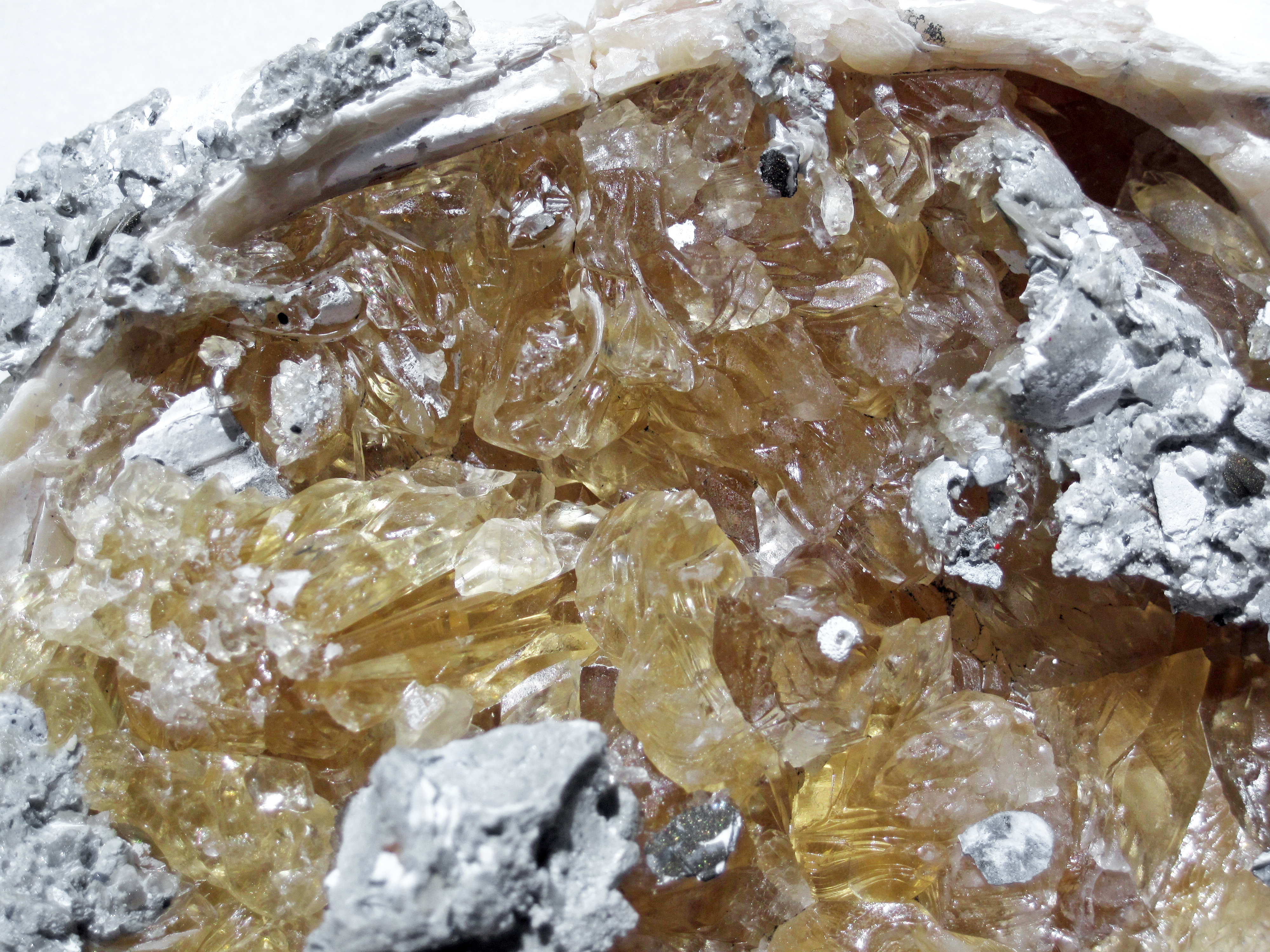
Coquina is a sedimentary rock formed from compressed shell fragments, and the deposits beneath northern Anastasia Island are among the most workable concentrations on the Atlantic seaboard. The stone cuts easily when first quarried and hardens on exposure to air. Its most strategically important property is that it absorbs cannonball impacts rather than shattering. A wall of harder stone struck by artillery fractures into lethal fragments; a coquina wall absorbs the ball and closes back around the wound. When Spanish engineers in the late 17th century needed permanent fortification material at St. Augustine, the island's quarry was the only practical answer within reach.
Quarrying began at what is now the Old Spanish Quarry in 1671, one year before construction of Castillo de San Marcos started on October 2, 1672. The fort took 23 years to complete; its walls average 12 feet thick and reach 19 feet on the ocean-facing side, all of it Anastasia Island coquina. But the quarry did not close when the Castillo was finished in 1695. Active extraction continued into the early 1900s - nearly 250 years of continuous operation, supplying building stone for Spanish colonial structures throughout the region long after the fort was done. This is the historical fact that visitor guides consistently understate. Most accounts frame the quarry as a Castillo construction project with a defined end. It was not; it was a working industrial site for two and a half centuries.
Who Cut the Stone
The labor force at the quarry is rarely named in standard visitor literature. The workforce included:
- Timucua from Spanish missions, working under compulsion as part of the colonial labor system imposed on indigenous communities
- Enslaved Africans brought to the quarry as property of the colonial administration
- Convicts transported from Cuba under penal labor arrangements
- Military engineers and skilled stonemasons sent from Spain to direct and perform technical cutting work
Workers cut blocks ranging from pieces a single person could carry on one shoulder to 2-foot-thick, 4-foot-long cubes that required six strong men to lift. Cut blocks were loaded onto barges and floated across Matanzas Bay to the Castillo site - the same water you look across today from the park beach, in roughly the same direction.
What Remains
The Old Spanish Quarries are listed on the National Register of Historic Places. The original excavation pits are still visible as shallow rectangular depressions near the park entrance. They can be accessed free of charge, before the vehicle fee checkpoint. Budget visitors who cannot pay the vehicle entrance fee - check floridastateparks.org for the current rate - can still walk to the quarry area and see the actual pits where colonial workers cut stone for one of North America's most intact Spanish fortifications. This free-access detail rarely appears in published guides.
The Beach Mouse at the Edge of Existence
The Anastasia Island beach mouse (Peromyscus polionotus phasma) is federally listed as endangered and is endemic to this barrier island. It exists in nature in exactly two locations: the northern end within Anastasia State Park, and the southern end within Fort Matanzas National Monument. Nowhere else on earth. Its historical range covered roughly 50 linear miles of barrier-island dune habitat along the Florida coast. That range has contracted to approximately 3 miles, split between two protected sites at opposite ends of the same island.
Anastasia State Park holds the largest population of the beach mouse on public land. In 1992, mice from Anastasia State Park and Fort Matanzas National Monument were released in the Guana River area to the north as a conservation backup strategy for a species whose entire wild existence sits within a few miles of coastline that major hurricanes cross regularly - though that reintroduction did not establish a lasting population. Check current USFWS recovery documentation for the status of ongoing conservation efforts for this subspecies.
What Threatens It
- Hurricane overwash events that flatten dune topography and destroy burrow systems overnight
- Coastal development across the middle of the island that eliminated habitat and severed the connection between the north and south populations
- Predation by domestic cats and other introduced predators that concentrate near residential areas adjacent to the park
- Dune destabilization from foot traffic through sea oat communities the mouse depends on for cover and burrowing substrate
The mouse is nocturnal and small - roughly 3 to 3.5 inches of body length (about 5 inches total with tail) - and most visitors never see one. The best chance comes at dusk along dune edges near the Ancient Dunes Trail, watching the base of sea oats and dune grasses for the small round burrow entrances that appear in loose sand. Stay on marked paths. The mice retreat from movement and sound; stillness is the only technique that works.
Geology and the Ancient Dunes Trail
The park sits atop two geologically distinct layers. The upper layer is Holocene sediment laid down roughly 4,500 years ago - relatively young material consistent with a modern barrier island. Below it and exposed in places through erosion are older Pleistocene-age deposits: beach-and-bar sand, dune sand, shelly sand, coquina, and hard limestone formed when sea levels were different and the Florida coastline occupied a different position than it does now. The coquina that workers cut from the quarry pits is part of this deeper Pleistocene layer.
Those Pleistocene deposits explain why the dunes on the Ancient Dunes Trail reach 10 to 20 feet - unusually tall for a Florida barrier island. Most barrier island dunes are low, recently formed ridges built by recent wind and wave action. The Ancient Dunes are older, more consolidated, and higher because they formed during an earlier episode of coastal construction and have since been stabilized by the hammock vegetation that now grows over them.
The Ancient Dunes Trail is one of the few places on Florida's Atlantic coast where you walk through a forest growing on top of dunes rather than around them - a hardwood canopy anchored to old geological structure that has been fixed in place long enough to support mature trees.
The 0.7-mile loop trail passes through a canopy of live oak, red bay, and cabbage palm above an understory of yaupon holly, saw palmetto, southern magnolia, and wax myrtle. This vegetation community is classified as maritime hammock - globally rare - and the stand here is one of the largest contiguous examples remaining on Florida's east coast. The trail's modest length does not reflect its scientific significance: intact maritime hammock of this extent, growing on Pleistocene substrate, is not a common thing.
The Lagoon Side
The Atlantic beach gets most visitor attention, but the western edge of the park facing the Intracoastal Waterway is a different kind of place. The Marsh Trail follows the lagoon edge through salt marsh and tidal creek habitat. Wildlife here is reliable and often visible at close range:
- Bottlenose dolphins working the tidal channels, particularly near low tide when fish concentrate in shallow water
- Wading birds year-round - great blue heron, tricolored heron, little blue heron - with roseate spoonbills appearing during winter months
- Alligators in the freshwater and brackish transition zones where marsh meets upland, especially in warmer months
- Ospreys nesting on channel markers visible from the shoreline trail
Anastasia Water Sports, the on-site concessionaire, rents kayaks, canoes, stand-up paddleboards, and sailboats for use on this sheltered lagoon water. The geometry matters: you are on the lee side of the barrier island, protected from Atlantic chop. Beginners and families with small children can paddle the lagoon without ocean exposure. The rental operation is accessible directly from within the park, no separate drive required.
Four Miles of Atlantic Shore
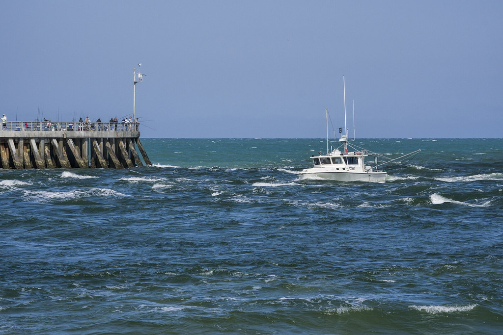
The park's Atlantic beach runs for 4 miles from the island's northern tip southward, backed by intact dune vegetation and free of the high-rise development crowding the coast further south. The beach is wide, the water is clear, and the volume of people is meaningfully lower than municipal beach access points a short drive away.
Three Named Surf Breaks
The park holds three named surf breaks that appear in no general visitor guide but are well known in northeast Florida surfing circles. All three activate on autumn Atlantic storm swells with offshore westerly winds grooming the faces from behind.
| Break | Position | Best Season | Wind |
|---|---|---|---|
| The Entrance | Near the park entrance road | Autumn through early winter | Offshore westerly |
| Middles | Mid-beach section | Autumn Atlantic swells | Offshore westerly |
| Blowhole | South end of park beach | Autumn storm swells | Offshore westerly |
Parking inside the park sidesteps the street competition that plagues the publicly accessible surf spots closer to downtown. Surfers should note that the dune base behind the breaks is active beach mouse habitat - the sea oat communities along the dune face are not a place to walk through or park gear.
Camping at Anastasia
The campground has 139 sites accommodating both tents and RVs, plus glamping bungalows for visitors who want a structure. The campground is among the most in-demand in the Florida State Parks system, and the booking situation requires a specific strategy rather than generic advice.
Nightly camping fees and the nonrefundable reservation fee are posted at the Florida State Parks reservation site - check there for current rates. The Coquina loop is the most requested by name. Sites vary in shade coverage and proximity to bathhouses; the reservation system includes a map showing individual site positions, which is worth reviewing rather than booking blind by loop name. Glamping bungalows follow the same 11-month window and also move quickly.
For a campground stay, work through this sequence in order:
- Set a calendar alert for exactly 11 months before your target arrival date, then log into the Florida State Parks reservation system and book as soon as the window opens.
- On arrival, stop at the Old Spanish Quarries before paying the vehicle entrance fee - the quarry area is accessible before the checkpoint and you can see the pits at no charge.
- After paying the entrance fee and checking in, orient yourself to the campground map before heading to the beach - the shortest walking route to the waterfront is not always obvious from site numbers.
- Ask the ranger station which dune areas near your campsite have active beach mouse burrows, so you can keep foot traffic away from those zones at night.
- Contact Anastasia Water Sports the first morning to reserve kayaks or paddleboards - rental availability shrinks fast when the campground is full on weekends.
Planning Your Visit
The park charges a per-vehicle entrance fee covering all occupants; check floridastateparks.org for the current rate. The park is open year-round with hours that shift slightly by season.
One-Day Circuit
Anastasia State Park anchors a logical single-day combination with three other significant sites:
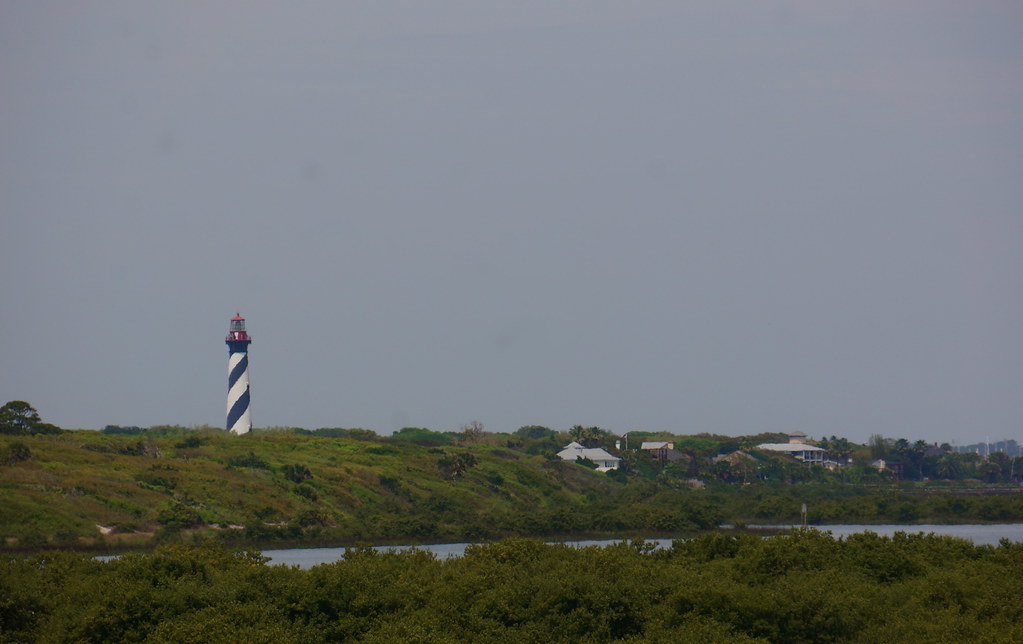
- The St. Augustine Lighthouse - 165 feet tall, lit in 1874 - stands just north of the park boundary on the same barrier island, reachable without backtracking; it is among Florida's most historically significant lighthouses (Florida's oldest operational lighthouse is the Amelia Island Light, first lit in 1839 - verify current operating status locally)
- Castillo de San Marcos, the fort built from this park's quarry stone, sits visible across Matanzas Bay and is a short drive or water taxi ride from the island
- Fort Matanzas National Monument at the south end of Anastasia Island - roughly 14 miles through the residential and commercial center of the island - protects the other surviving wild population of the beach mouse
On the Heritage Crossroads Corridor, this park is where the coquina story begins. The same rock quarried from the pits near the entrance appears in the Castillo's walls, in historic structures throughout St. Augustine, and in smaller concentrations in buildings up and down the corridor the heritage highway now traces. Standing at the quarry pits and then crossing to walk inside the Castillo is a specific experience that photographs do not prepare you for: the same material in two states, separated by a few hundred meters of bay water and three and a half centuries of history.
Frequently Asked Questions
Can I visit the Old Spanish Quarries without paying the park entrance fee?
Yes. The quarry pits are located just inside the park entrance, before the vehicle fee checkpoint. You can walk to the quarry area without paying the vehicle entrance fee. The fee checkpoint further into the park is where the charge applies for access to the beach, campground, and trails.
Is the Anastasia Island beach mouse likely to be seen during a daytime visit?
Unlikely. The beach mouse is nocturnal and spends daylight hours in burrows beneath the dune vegetation. Campers have the best chance of a sighting, watching quietly at dusk near the dune base along the Ancient Dunes Trail where burrow entrances appear as small holes in the sand at the base of sea oats. Stay on marked paths regardless - dune foot traffic damages burrow systems whether you see the mouse or not.
How far in advance do I actually need to book a campsite?
For peak weekends, the realistic answer is exactly 11 months in advance, on the first day the reservation window opens. Florida State Parks allows reservations up to 11 months out, and the most popular sites at Anastasia - particularly in the Coquina loop - often fill within hours of that window opening. "Book early" is not actionable advice for this campground; booking on the precise first eligible day is the actual target. Verify the current booking window and reservation policies at the Florida State Parks reservation site before your planning date.
What is the difference between the Ancient Dunes Trail and the Marsh Trail?
The Ancient Dunes Trail is a 0.7-mile loop through a forested maritime hammock on Pleistocene-age dunes 10 to 20 feet high - the focus is geology, plant communities, and beach mouse habitat. The Marsh Trail runs along the lagoon side of the park facing the Intracoastal Waterway, through salt marsh and tidal creek edges where the primary draw is wildlife: dolphins, wading birds, and alligators. They are complementary, not overlapping, and both are short enough to walk on the same visit.
When are the surf breaks at Anastasia best, and can beginners use them?
All three breaks - The Entrance, Middles, and Blowhole - are at their best during autumn Atlantic storm swells with offshore westerly winds. Florida's northeast coast is not a consistent surfing destination year-round; autumn is when the Atlantic produces the groundswell that makes these breaks work. Beginners are better served by the sheltered lagoon on the park's Intracoastal side, where Anastasia Water Sports rents equipment for flat-water paddling with no ocean exposure.
How does the park connect to the broader Heritage Crossroads Corridor?
Anastasia State Park sits at the St. Johns County end of the Heritage Crossroads Corridor and is where the corridor's coquina material history originates. The rock quarried here for nearly 250 years built not only Castillo de San Marcos but also shaped the architectural character of St. Augustine and other communities the corridor passes through. Visiting the quarry pits and then following the heritage highway north into Flagler County traces the path the coquina stone story takes as it moves through the region - from extraction point to built environment.