Drive State Road A1A north from Flagler Beach into the Hammock and you travel a narrow strip of sand and shell rock with saltwater on both sides. To your east, Atlantic surf breaks. To your west, the flat tidal channel of the Intracoastal Waterway mirrors the sky. Most visitors glance once at the water and keep going. What almost nobody realizes is that the channel to your left is not natural geography - it is the product of a 29-year private engineering project financed not with federal dollars but with more than a million acres of Florida public land, and it ended on a Monday morning when a dredge boat cut the last plug of earth and made that strip of ground an island for the first time in recorded history.
Two Corridors, One Story
The Heritage Crossroads Highway traces 98 miles through Flagler, St. Johns, and Volusia counties, running mostly along A1A and US-1. About a mile to its east, or sometimes right alongside it, the Atlantic Intracoastal Waterway follows a parallel line for the same distance. The highway and the waterway share more than proximity. They were built in the same era, driven by the same economic forces, and shaped by the same man: Henry Flagler, the Standard Oil partner who turned northeast Florida from a malarial coast into a winter resort corridor.
Today the Heritage Corridor is promoted for its lighthouses, surfing beaches, and small-town main streets. The waterway gets a separate audience - cruising guides, fishing reports, paddle trail maps. No travel resource puts the two together, which means visitors on both sides of A1A are missing half the story. The channel you see from the bridge at Flagler Beach is not background scenery. It is the same infrastructure project that built the railroad town you just drove through.
The Geography Before the Dredge
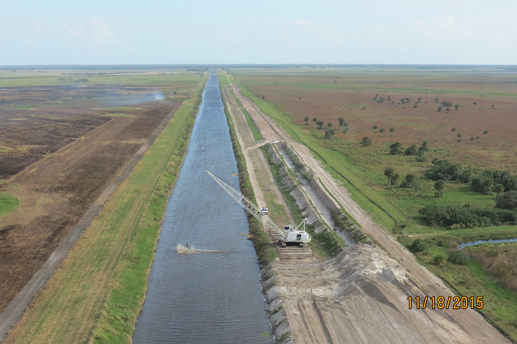
To understand what was cut in 1907, you need to see what existed before. The Matanzas River begins just south of St. Augustine and runs south along the inside of Anastasia Island, narrowing near the present-day Marineland area before ending in a shallow tidal system. The Halifax River begins near the Flagler-St. Johns county line and runs south through Ormond Beach. Between those two river systems lay the Hammock - a dense, subtropical barrier strip of live oak, saw palmetto, and cabbage palm that had never been fully surrounded by tidal water.
The Timucua people who inhabited this coast for thousands of years knew the Hammock as connected land. Spanish missionaries who established their mission chain along the barrier island in the seventeenth century could ride or walk the full length of what is now Flagler County without crossing open water. Nineteenth-century settlers used the Hammock as a source of building timber and as a storm buffer. None of them crossed an island to get there, because it was not an island.
Coastal commerce paid a real price for this gap. Any boat wanting to move cargo from the Halifax River north to St. Augustine had one option: run outside through St. Augustine Inlet and along the open Atlantic coast, fully exposed to the shoaling and swells that made this stretch dangerous in bad weather. A sheltered inside passage was an obvious need. Meeting that need proved far harder than anyone anticipated.
The 1881 Deal: Swampland for Canal Miles
In May 1881, four St. Augustine businessmen formed the Florida Coast Line Canal and Transportation Company with the aim of dredging a protected inland channel the full length of the Florida coast. The founders were:
- Dr. John Westcott, the driving engineering mind behind the project
- Henry Gaillard, a local businessman with capital and St. Augustine connections
- James M. Hollowes, one of the original incorporators
- James L. Colee, the fourth partner who rounded out the founding group
They had a problem that would persist throughout the project: Washington would not pay for it. The federal government declined to finance the work, and private capital alone could not sustain excavation across hundreds of miles of swamp and tidal flat.
The solution was a land swap written into Florida statute. The state legislature agreed to grant the company 3,840 acres of public swampland for every completed mile of canal - the entire state quota of land grants per mile available under the law. For every mile of finished waterway the company delivered, it received land it could sell or leverage to fund the next mile. The state had vast acreage of mosquito-thick swampland nobody was buying, and it needed infrastructure it could not otherwise fund. The logic was merciless but practical.
By 1912, after more than three decades of dredging, the state had granted the company over one million acres of Florida public land in exchange for 268 miles of completed waterway between Jacksonville and Miami. Boosters called it visionary infrastructure finance. Critics called it the largest giveaway of Florida public land in the state's history. Both descriptions were accurate.
Henry Flagler Acquires the Canal Company
In 1893 Henry Flagler - already the builder of the Florida East Coast Railway and the creator of the Ponce de Leon Hotel in St. Augustine - purchased the Florida Coast Line Canal and Transportation Company. The acquisition was not sentimental. Flagler's FEC Railway needed the land grants attached to the canal company to push his railroad south of Daytona, and the canal company needed his capital to keep dredging through territory that was bankrupting it.
The arrangement Flagler negotiated added a new layer to the land grant formula. He received 1,500 acres of canal land grants for every additional mile he extended the FEC Railway south of Daytona. The railway and the waterway became the same financial instrument. Each southward push of the track line generated land grant revenue that could subsidize the continuing canal work, and the canal's completed stretches validated land values along the railway corridor he was selling.
This is the connection that almost no Heritage Corridor visitor content makes explicit. The FEC Railway stations, the resort hotels, the land development that eventually built out Flagler Beach and Palm Coast - all of it ran through a single 1893 deal that tied a canal dredge to a locomotive. The Intracoastal Waterway visible from A1A through the Heritage Corridor is a Flagler project in exactly the same sense as the Ponce de Leon Hotel or the Overseas Railroad to Key West.
The Hardest Cut: Four Years Through the Hammock
Why the Hammock Was Different
Canal work on the Florida coast fell into two rough categories. South of the Hammock and north of it, dredges could work through shallow tidal marshes and back bays where the material was soft. The Matanzas-Halifax section through the Flagler County Hammock was neither. Here the company had to excavate through a continuous band of dry hammock terrain - live oak upland, not marsh - for fourteen miles, moving a volume of earth and root material greater than any other single section of the entire 268-mile project.
By 1903 dredges had reached the northern end of the Matanzas-Halifax segment, working south from St. Augustine. The work was slow. The mechanical dredges of the period were steam-powered, floating on their own hulls, advancing by anchoring a spud at the bow and winching forward. They could move rock and shell marl, but the Hammock terrain presented dense root masses, hardwood stumps, and irregular depth profiles that the equipment of the era was not designed for. It took four more years to cover fourteen miles.
The Dredge 'South Carolina'
The vessel assigned to the final stage of the cut was the dredge boat South Carolina. By the spring of 1907 the channel from both ends had advanced close enough that only a single plug of earth remained - the last obstruction separating the Matanzas Bay system from the Halifax River. On Monday, May 13, 1907, at precisely 8:00 a.m., the crew of the South Carolina made the final cut.
The waters of Matanzas Bay and the Halifax River joined for the first time, and the strip of land between them became an island - a geographical fact that would hold for as long as the channel was maintained.Flagler County Historical Society, Hammock History
The change was immediate and physical. The land that is now Flagler Beach and the Hammock - a strip of ground the Timucua had inhabited, Spanish missionaries had walked, and nineteenth-century timber cutters had worked - was now completely surrounded by water. Not an island in any approximate sense. A true island, for the first time in recorded history, created at a known hour on a known day.
What the May 13 Cut Actually Changed
The geographical change had effects that still shape the corridor. Completing the connection altered tidal dynamics across the entire system. What had been a semi-closed estuary at the Matanzas-Halifax divide now flushed with tidal exchange in both directions. The practical results were significant:
- Marine species that could not previously transit the area had a continuous channel for the first time, changing the ecological composition of both the Matanzas and Halifax systems over the following decades.
- The barrier island's position as a buffer between the protected waterway and the Atlantic became permanent rather than seasonal or incomplete.
- Produce boats, lumber schooners, and passenger vessels that had been running the dangerous coastal outside route now had a sheltered alternative from Jacksonville to Miami without a single ocean crossing.
- Real estate in the Hammock acquired a new characteristic: island property commands different prices and carries different development logic than mainland property, and Flagler had anticipated that shift when he bought the canal company in 1893.
Tolls, Federal Takeover, and the Purchase
The canal company's operating model shifted after the channel was complete. State authorities first permitted the company to collect tolls from vessels at various points as early as 1911. The mechanism was direct: a chain was stretched across the canal at each collection point and released to the channel bottom only after a boat's crew paid. Passenger vessels, cargo boats, and pleasure craft each paid different rates. By the early 1920s, toll collection points operated at as many as six locations along the waterway from Jacksonville south, and the waterway that had been built with Florida public land was extracting revenue from the same public that had funded it.
The political response was not immediate but it was decisive. The Florida Inland Navigation District was created in 1927 as the state began laying the legal groundwork to bring the waterway into public control. Two years later, in 1929, the State of Florida completed the purchase of the full waterway from the company and transferred it, along with the necessary right-of-way, to the U.S. Army Corps of Engineers for perpetual free public maintenance. The deal that began with swampland grants to four St. Augustine businessmen ended with a state purchase and federal handover - check Florida state archives for the recorded purchase figure, which is part of the documented legislative record of that year.
The Army Corps has maintained the waterway since. The federal project specifies a minimum channel depth for this segment, though actual controlling depths vary due to natural shoaling and are restored periodically by maintenance dredging. For current depth data, check NOAA chart 11485 or the Army Corps active notices for the Florida ICW rather than any printed guide. The Atlantic ICW runs approximately 1,244 miles from Norfolk, Virginia to Key West, Florida - the officially measured span from Mile Marker 0 at Norfolk to Mile 1243.8 at Key West. The broader U.S. Intracoastal Waterway system, including Gulf Coast routes, covers roughly 3,000 miles in total. The northeast Florida segment - including the Heritage Corridor's stretch - is one of the most historically significant links in the Florida portion of the route.
Boating, Fishing, and Paddling Access Along the Corridor
The Heritage Crossroads corridor has four practical ICW access points in or near Flagler County. Each serves a different kind of user, and each puts you on the same waterway the South Carolina finished in 1907.
| Access Point | Launch Type | Powerboat Access | Kayak/Canoe | Extras |
|---|---|---|---|---|
| Gamble Rogers Memorial State Recreation Area, Flagler Beach | Paved ramp plus separate sandy hand-carry area | Yes | Yes, dedicated launch | Camping, restrooms; state park fee applies - check floridastateparks.org for current rate |
| Bing's Landing County Park, the Hammock near Palm Coast | Paved ramp | Yes | Yes | Weekend kayak rentals; picnic area; sits on the 1907 cut section |
| Wadsworth Park, State Road 100, Flagler Beach | Hand carry, small boat | Limited | Yes | Town park setting; no ramp for trailered boats |
| River to Sea Preserve, near Flagler/St. Johns county line | Hand carry | No | Yes | Nature preserve; walking trails; northern end of corridor reach |
Planning Your Launch
If you want to paddle the section of waterway that was dredged last - the hardest fourteen miles of the entire project - Bing's Landing puts you directly on it. The park sits in the Hammock on the exact stretch of channel that the South Carolina opened in 1907. Weekend kayak rentals make it accessible without your own equipment; call ahead or check Flagler County Parks for current seasonal hours before you drive out.
For a longer powerboat run or a family with gear, Gamble Rogers State Recreation Area offers the most infrastructure. The paved ramp, parking, restrooms, and campsite access make it the right base for a multi-day trip. River to Sea Preserve suits paddlers who want to explore the northern end of the corridor's ICW reach, where the channel transitions into the Matanzas River system - the same river system the canal company spent years trying to connect to the Halifax.
- Check current tidal conditions before launching. The ICW through the corridor is fully tidal, and an outgoing tide against a north wind produces chop that surprises first-time paddlers on what looks like a calm channel.
- Verify current channel depths if you are trailering a boat with meaningful draft - shoaling occurs between Army Corps maintenance cycles and conditions change. NOAA chart 11485 covers this section.
- Read the navigation markers before you leave the ramp. On the Atlantic ICW, 'red-right-returning' applies with southbound as the 'returning' direction - boats heading south from Norfolk toward Key West keep red markers to starboard. Northbound boats keep red markers to port (left). Confirm the convention against a current chart or navigation guide before your first run.
- If you plan to use weekend kayak rentals at Bing's Landing, confirm availability in advance. Hours and rental schedules vary by season.
- Leave a float plan with someone onshore. Cell coverage is generally good along the corridor, but the ICW carries commercial and recreational powerboat traffic at speed and a hand-carry craft is small in that channel.
What to Watch for on the Water
Wildlife You Will Actually See
The ICW through the Heritage Corridor looks different from a boat than from a car window on A1A. The western bank is mostly undeveloped marsh grass and tidal flat - the kind of shoreline that has not changed substantially since the South Carolina finished the channel. The eastern bank alternates between private docks, preserved scrub, and the occasional boat ramp. The water between them is genuinely productive wildlife habitat.
- Bottlenose dolphins work the channel regularly, often following trawlers for disturbed baitfish or riding the bow pressure wave of larger powerboats.
- Brown pelicans and double-crested cormorants roost on the channel markers - the same green and red posts that guide navigation also function as fishing platforms for birds throughout the day.
- Manatees use the ICW corridor seasonally, particularly in cooler months when they seek warmer water. Slow-speed manatee zones are marked and legally binding; watch your wake near posted markers.
- Osprey nest on channel markers and utility poles along the western shore through spring and early summer - active nests are clearly visible from the water and easy to spot from a kayak.
- Redfish, snook, and flounder hold in the grass edges along the western bank; the marsh fringe visible from a low-profile kayak is exactly the habitat type where these species concentrate.
What the Channel Itself Tells You
One thing worth noticing from the water: the low, scrubby hummocks visible along the western bank of the channel through the Hammock section are not natural upland. Much of that material is dredge spoil - the excavated hammock earth piled by the South Carolina and the other dredges during the 1903-1907 cut. More than a century of vegetation has colonized it, but the physical residue of the digging is still sitting where it was placed. What looks like scrub island is the by-product of the engineering project that created the channel alongside it.
Frequently Asked Questions
Was the barrier island at Flagler Beach always an island?
No. The strip of land that includes present-day Flagler Beach and the Hammock was not completely surrounded by water until 8:00 a.m. on May 13, 1907, when the crew of the dredge boat South Carolina completed the final cut connecting Matanzas Bay to the Halifax River. Before that date, the land connected to the mainland at its southern end through the Matanzas-Halifax divide. The Timucua, Spanish missionaries, and nineteenth-century settlers knew it as continuous, walkable terrain with no water crossing required.
Who built the Intracoastal Waterway through northeast Florida, and how was it paid for?
The Florida Coast Line Canal and Transportation Company - formed in St. Augustine in 1881 - built the waterway from Jacksonville to Miami over nearly three decades. The federal government declined to fund the project, so Florida's legislature agreed to grant the company 3,840 acres of public swampland for every completed mile of canal. By the time the project was finished, the state had transferred over one million acres of public land to the company. In 1929 the state purchased the waterway back and transferred it to the Army Corps of Engineers for free public use; Florida state archives hold the documented terms of that purchase.
What is the best launch point for paddling the historic 1907 dredge section?
Bing's Landing County Park in the Hammock near Palm Coast sits directly on the section of waterway that took four years to complete and was the hardest-dredged stretch of the entire Florida ICW project. The park has a boat ramp and offers weekend kayak rentals, placing you on the exact water the South Carolina opened. Wadsworth Park in Flagler Beach is a second hand-carry option on the same corridor stretch for paddlers who do not need a ramp.
Does Henry Flagler have a direct connection to the Intracoastal Waterway, not just the railroad?
Yes, a direct ownership connection. Flagler purchased the Florida Coast Line Canal and Transportation Company in 1893, making him the owner of both the railroad and the canal project simultaneously. The deal gave him 1,500 acres of canal land grants for every mile he extended the FEC Railway south of Daytona, binding the two projects into a single land-development operation. The waterway visible from A1A through the Heritage Corridor is a Flagler project in the same concrete sense as the FEC Railway tracks running parallel to it a few miles inland.
Is the Intracoastal Waterway through Flagler County free to use?
The channel itself carries no toll since the state transferred the waterway to the Army Corps of Engineers in 1929. Access at managed launch points is a separate question - Gamble Rogers Memorial State Recreation Area charges a state park entry fee (check floridastateparks.org for the current rate before you go), while other access points along the corridor may be free or charge a nominal launch fee. Contact Flagler County Parks or the individual parks directly for current access details, as fees and hours change seasonally.
How does the Heritage Corridor ICW stretch fit into the larger Atlantic Intracoastal Waterway?
The Atlantic ICW runs approximately 1,244 miles from Norfolk, Virginia to Key West, Florida - officially measured from Mile Marker 0 at Norfolk to Mile 1243.8 at Key West. The broader U.S. Intracoastal Waterway system, which includes Gulf Coast routes, spans roughly 3,000 miles in total. The Heritage Corridor's stretch - from the Flagler-St. Johns county line south through Flagler County to the Flagler-Volusia line - is a short segment in that total distance but historically one of the most significant: it includes the Matanzas-Halifax section that was the last major gap closed in the Florida portion of the waterway, and it remained physically open until 1907, decades after the rest of the route was navigable.