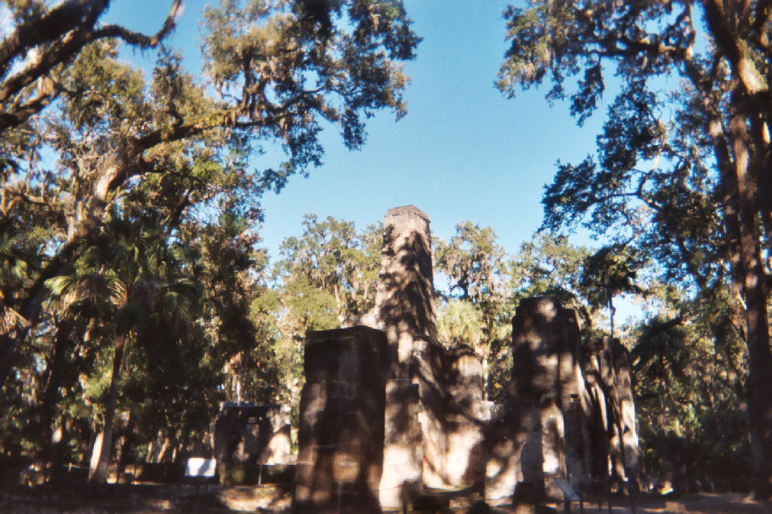
Walk the river loop at Tomoka State Park and you are crossing ground that enslaved workers drained and cleared in the 1760s. Drive the unpaved stretches of Old Kings Road through Flagler County and you are following a route surveyed by British military engineers before the United States existed. The Heritage Crossroads Corridor carries more British-period archaeology per mile than almost anywhere else in North America, yet the 20-year chapter that produced it - 1763 to 1783 - rarely gets the full story in one place. Britain received a nearly empty Florida, built a plantation economy on indigo and forced labor, sheltered the loyalist survivors of the American Revolution, and then walked away almost completely, leaving ruins for the next two centuries. What those ruins are, where they sit, and who made them is what this guide covers.
The 1763 Transfer: How Spain Traded Florida for Havana
The Seven Years' War ended with Britain holding one of Spain's most valuable Caribbean possessions - Havana. Spain wanted it back badly enough to trade all of Florida. The 1763 Treaty of Paris, signed in February of that year, made the exchange formal: Britain got Florida, Spain got Havana. For Spain, it was a reasonable bargain. Florida had been a drain for two centuries - its towns sparse, its agriculture thin, its value almost entirely strategic as a buffer against British Carolina.
What Britain received was closer to a wilderness title than a working colony. Spanish settlers had largely withdrawn by the time British officials arrived. The land itself was real - hundreds of miles of navigable rivers, fertile Atlantic coastal plain soils, longleaf pine forests of commercial potential - but the workforce, the infrastructure, and the capital were all absent.
King George III formalized the colonial structure on October 7, 1763, with a Royal Proclamation that divided Florida into two provinces. East Florida would be governed from St. Augustine, West Florida from Pensacola. The Apalachicola-Chattahoochee river system marked the line between them. East Florida's northern boundary was drawn at the St. Marys River - the same line separating Florida from Georgia today. Both provinces needed to be populated from nothing, in terrain that most potential settlers had never seen.
Building from Scratch: Governor Grant, the Land Grant System, and Who Actually Arrived
Colonel James Grant arrived in St. Augustine on August 29, 1764, as the first royal governor of British East Florida. He found a town of a few hundred Spanish holdovers, some British soldiers, and no agricultural economy. His assignment was to attract settlers with capital and practical farming knowledge.
The mechanism was land grants. Britain offered large acreage grants to any qualified applicant who could demonstrate intent to cultivate. The system drew planters from South Carolina and Georgia - men who already knew plantation agriculture, who had existing contacts in London indigo and timber markets, and who arrived with enslaved workforces. This made East Florida's settlement pattern unlike most British North American colonies: it was plantation-centered from day one, without a phase of smallholder farming preceding it.
Grant led by personal example. He established Grant's Villa, a substantial indigo operation approximately six miles northwest of St. Augustine, positioned between the North and Guana rivers. It became the most productive indigo plantation in the province. The governor working his own grant rather than simply administering others gave the scheme credibility with potential investors in London and demonstrated that the subtropical terrain could actually yield a commercial crop.
The Carolina Connection
The planters who responded to the grant offers did not arrive empty-handed. They brought enslaved workers from their Carolina and Georgia operations - in some cases entire existing field crews. This transfer of labor from the established plantation belt of the Carolinas into East Florida explains how a colony with almost no white settlers managed to begin large-scale export agriculture within just a few years of its founding. The plantation system arrived essentially fully formed because the people forced to operate it were already trained, already in Florida, and had no say in the matter.
The King's Road: 150 Miles of Plantation Infrastructure Through the Corridor
A plantation economy needs a road. Britain began building one in 1763, shortly after the Treaty of Paris, and completed a serviceable track by late 1767, with construction continuing through 1773. The finished road ran roughly 150 miles from the St. Marys River on the Georgia border south through St. Augustine and on to Andrew Turnbull's settlement at New Smyrna, near Mosquito Inlet.
The road passed directly through what is now the Heritage Crossroads Corridor. Without it, the timber, indigo, and rice moving from Halifax River and Tomoka River plantations would have had no reliable overland route to St. Augustine's port facilities. It was not a highway in any modern sense - closer to a wide cleared path with bridges at major crossings - but it was the spine of the colony's commercial geography. Every plantation along the corridor depended on it.
Old Kings Road through Flagler County follows the same general alignment that British engineers laid out. Some stretches have been paved and absorbed into the county road network. Others remain unpaved passages through pine and oak canopy that feel genuinely removed from the present. The road also carries a human story beyond commerce: in 1777, the surviving indentured workers from Turnbull's collapsed New Smyrna colony walked this corridor north to St. Augustine - roughly 75 miles on foot - to appeal for their freedom from indenture contracts a colonial court eventually ruled void.
The Indigo Economy: Blue Gold and What It Cost to Produce
Indigo was East Florida's dominant export throughout the 1760s and 1770s. The plant produces a blue dye extracted through fermentation, and it commanded strong prices in British textile markets at a time when blue fabric was fashionable and difficult to produce without natural sources. Indigo was also used as a paint pigment and a cosmetic. By 1776, East Florida's plantations were shipping tens of thousands of casks per year - a figure that reflects how quickly the grant system had scaled production from almost nothing in 1764.
The plant required two to three harvests per year, with the most intensive labor falling in July, August, and September - the hottest and most humid months on the Florida coast. The extraction process was a genuine sequence workers repeated crop after crop:
- Enslaved workers cut the pea-like indigo plants at the stem and carried them to the processing area.
- The cut plants were packed into the first vat - called the steeper - and submerged in water to begin fermentation.
- Over roughly fifteen hours, the plant matter broke down and released indigo-bearing liquid into the water.
- Workers drew the liquid into a second vat - the beater - and agitated it continuously by hand or with long paddles to oxidize the indigo and form suspended particles.
- The settled indigo paste was drained into a third vat, pressed into dry cakes, and boxed for shipment to British ports.
Enslaved Africans and the Labor Foundation of East Florida
The indigo economy did not build itself. British planters arriving from the Carolinas and Georgia brought more than 9,000 enslaved Black workers into East Florida over the course of the British period. The raw population figures tell part of the story: at the start of the American Revolution in 1775, the province had approximately 3,000 white settlers and 2,500 enslaved Africans - making it the smallest and most rural of any British North American colony.
That disproportion deepened as the Revolution continued. By early 1783, as loyalist refugees crowded into East Florida from collapsing British positions elsewhere in the South, the enslaved population had grown to an estimated 9,000 to 11,000 people out of a total provincial population approaching 17,000.
The physical record of that labor force is still present in the landscape. The drainage ditch networks that converted coastal swampland into farmable fields - visible in satellite imagery at Tomoka State Park as faint linear depressions - were dug by hand. The earthworks associated with rice and indigo cultivation along the Halifax and Tomoka rivers were raised and leveled by enslaved workers, many of whom brought the wetland agricultural knowledge that made coastal cultivation viable in the first place, drawing on farming traditions from West and Central Africa.
What the 1783 Treaty of Paris meant for these individuals is the most undercovered part of the corridor's history. Some enslaved people were taken by evacuating planters to the Bahamas or Jamaica and forced to continue plantation labor there. Others were sold before departure as planters liquidated assets. Some escaped into the Florida interior or to Seminole and Creek communities during the chaotic evacuation period. Official records of individual fates are thin. The British evacuation was organized around the interests of the planter class; the people whose labor had cleared, drained, and planted the entire corridor were not its organizing concern.
Turnbull's Disaster and the Minorcan March: New Smyrna 1768-1777
Andrew Turnbull's New Smyrna colony was the most ambitious single act of colonization in British America. In 1768, financed in part by Sir William Duncan - an associate of Governor Grant - Turnbull transported roughly 1,500 indentured workers from Greece, Italy, and Minorca to a plantation site just south of Mosquito Inlet. It was the largest single European colonization attempt in British North America at the time, and it failed badly.
The indenture contracts were onerous even by the standards of the era. Workers died from disease, overwork, and violence at rates that made the scheme unsustainable from the first seasons. By 1777, the survivors - predominantly Minorcan - had reached their limit. They walked out.
Their route was King's Road. Roughly 75 miles on foot from New Smyrna north to St. Augustine, the Minorcan workers arrived and petitioned the colonial court for relief from their contracts. The court ruled the indentures void. The survivors settled in St. Augustine, where their descendants remained after Spain returned.
The Minorcan story runs deeper than a labor dispute. These workers arrived in 1768 - six years before the Revolution began and fifteen before it ended the British period entirely. They survived Turnbull's failed experiment, survived the upheaval of war years in a loyal colony surrounded by a widening conflict, and outlasted every planter who had brought them there. The road they walked in desperation in 1777 is the same road travelers follow on the Heritage Crossroads today.
The Fourteenth Colony: East Florida and the American Revolution
East Florida never joined the rebellion. When the Continental Congress made its case in 1775 and 1776, East Florida's planters had been in the province for less than a decade, most of them on land grants that existed only because of the Crown. Loyalty, in that context, was rational. The province maintained British military posts throughout the conflict and remained stable as the war tore through Georgia and the Carolinas to the north.
The consequence was an enormous influx of loyalist refugees. As British forces lost ground in the South - Georgia beginning in late 1778 and the Carolinas through 1780 and 1781 - thousands of loyalist families, with their enslaved workers and whatever property they could carry, moved into East Florida. The province that had housed perhaps 3,000 white settlers in 1775 found itself sheltering a population approaching 17,000 by early 1783 - an increase of more than 400 percent in under a decade.
Modern historians sometimes call East Florida "the Fourteenth Colony" to mark its place in the Revolutionary geography: the one colony that held, that became a haven, that watched the war from a position of stability. For travelers, the frame is useful because it explains the construction visible in the late-1770s and early-1780s archaeological record. Those ruins were not all built in the original 1760s grant era - some represent investment made by loyalist arrivals just years before the entire British project collapsed.
Richard Oswald's Irony: The Man Who Owned Tomoka Gave It All Away
In 1766, the British government granted Scottish merchant Richard Oswald a large tract along the Halifax and Tomoka rivers - the land that now contains Tomoka State Park in Ormond Beach. Mount Oswald Plantation operated that grant, producing a range far wider than most corridor sites managed:
- Indigo - the primary export cash crop, processed through the vat system in the wetland clearings east of the river
- Rice - grown in the drained coastal lowlands
- Timber - from the longleaf pine forests inland from the river bottoms
- Molasses and rum - processed from sugar cane on the richer alluvial soils
- Oranges - in what may be one of the earliest commercial citrus operations in Florida's recorded history
Oswald himself was never primarily a Florida colonist. He was a London merchant and diplomat of considerable standing, who managed the grant at a distance through overseers. After the American Revolution effectively ended British control of the South, the British government needed a skilled negotiator to work out final terms with Continental representatives in Paris. They chose Oswald.
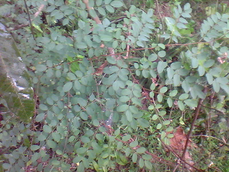
He sat across the table from Benjamin Franklin, John Adams, and John Jay. On September 3, 1783, the Treaty of Paris was signed, transferring East Florida back to Spain. The man who had received one of the largest land grants on the Halifax and Tomoka rivers had just handed the entire province to a foreign power. Mount Oswald was formally abandoned in 1785 when the last British settlers departed. The indigo plants Oswald's workers introduced did not leave with them. Naturalized indigo still grows wild in the Tomoka-Ormond Beach area - an inadvertent botanical record of the plantation era visible to anyone who knows what it looks like on the park's trails.
The 1783 Evacuation and the Ruins Left Behind
The Treaty terms gave British subjects in East Florida 18 months to evacuate or swear loyalty to Spain and convert to Roman Catholicism. Few were willing to accept those conditions after a decade or more of building estates. Brigadier General Archibald McArthur organized the departure. Evacuees scattered across four main destinations:
- The Bahamas - the most common choice for East Florida planters, where some attempted to restart plantation operations on grant land
- Jamaica - particularly for those with existing Caribbean commercial connections
- Nova Scotia - which absorbed a large loyalist population from across the former colonies
- Britain - for those with family ties or merchant networks to return to
The evacuation stretched through 1784 and into 1785. As each planter left, the plantation infrastructure - cleared fields, drainage ditches, buildings, the King's Road itself - began reverting without maintenance. Within a generation, longleaf pine and palmetto had reclaimed most of what had been cultivated ground. The corridor that had sheltered 17,000 people in 1783 held almost no one by 1790.
Reading the British Period in Today's Corridor
The corridor's physical record of the British period is specific and visitable. The table below maps the major plantation sites to their current form for travelers planning a route.
| Site | Original Grant Holder | Primary Products | Current Form |
|---|---|---|---|
| Grant's Villa | Gov. James Grant | Indigo | Guana River corridor, St. Johns County |
| Mount Oswald | Richard Oswald | Indigo, rice, timber, rum, oranges | Tomoka State Park, Ormond Beach |
| Damietta | Ormond family | Cotton, indigo | Central Ormond Beach, absorbed into urban grid |
| New Smyrna colony | Andrew Turnbull | Indigo (attempted) | Ponce Inlet area, Volusia County |
At Tomoka State Park, the indigo-era drainage ditches survive as low linear depressions crossing the trail system - some visible in satellite imagery as faint parallel marks in the soil. Standing at the confluence of the Tomoka and Halifax rivers, visitors are at the operational center of Mount Oswald Plantation. The indigo connection near St. Augustine traces back to Grant's Villa, six miles northwest of the city in the terrain now protected as the Guana River Wildlife Management Area. The Damietta plantation in Ormond Beach is not a park or preserved site; the street grid of central Ormond Beach overlays what was once a combined cotton-and-indigo operation of the Ormond family - a reminder that the British-period footprint extends into ground that looks entirely ordinary today.
The second Spanish period that followed the evacuation did not rebuild on the British agricultural footprint. Spain's colonial priorities in Florida ran toward defense and trade rather than the plantation agriculture the British had developed, and the cleared wetlands and drainage networks along the Halifax and Tomoka reverted without a competing land use to interrupt them. What reads as deliberate preservation from a modern trail is more often the result of subsequent history having no strong economic reason to fill the ditches or straighten the road lines. The British layer survives in the corridor partly because two centuries of different priorities left it in place - shaped into the ground by the people who built it, and left there by the people who came after.
For current trail access, seasonal hours, and entry information at Tomoka State Park and other corridor sites, check the Florida State Parks system directly - conditions and access points change and no secondary guide can keep them current.
Frequently Asked Questions
What can I actually see of the British period along the corridor today?
The clearest surviving evidence is at Tomoka State Park in Ormond Beach, where indigo-era drainage ditches remain as ground-level depressions across what are now park trails, some detectable in satellite imagery. Old Kings Road through Flagler County follows the British colonial road alignment, with unpaved sections that trace the original route through pine and oak canopy. The Guana River corridor northwest of St. Augustine corresponds to the area of Governor Grant's personal indigo operation. These are landscape features - altered ground, old road lines, drainage geometry - rather than standing structures, so knowing what to look for makes a substantial difference.
Why did East Florida never join the American Revolution?
East Florida's position made the war actively present rather than distant. The province served as a staging base for British military operations into Georgia, with troops, loyalist militia, and supply movements running through the corridor throughout the mid-war period. Georgia Patriots made incursions into the northern reaches of the province in return - the border was contested, not calm. For settlers along King's Road, the conflict was a condition of local geography, not an abstraction. The loyalist arrivals that swelled the population were not a gradual demographic shift but a compressed emergency: thousands of families reaching East Florida with whatever they could carry as British positions in Georgia and the Carolinas collapsed. What the corridor's late-1770s and early-1780s construction record reflects is not a colony that sat out the war comfortably - it reflects investment made under active wartime conditions by people who expected to hold ground the 1783 treaty ultimately transferred.
What happened to the enslaved people when Britain evacuated in 1783?
The clearest continuation is the Bahamian plantation transplant. The planters who chose the Bahamas - the most common evacuation destination - took their enslaved workforces and attempted to replicate the Florida system on Crown grants there, growing the same crops through the same methods on new land. The 1783 evacuation was not an ending for those people but a forced relocation into another iteration of the same system. British abolition of slavery did not come until 1833, meaning those taken from East Florida in 1784 and 1785 and their descendants remained enslaved for another fifty years after the Florida evacuation. The corridor's interpretive history tends to treat 1783 as the story's close; for most of the people whose labor created what travelers see today, it was a transition between one form of plantation labor and another.
Who was Richard Oswald and why does he matter to the corridor?
Oswald received one of the largest land grants on the Halifax and Tomoka rivers in 1766 and later served as Britain's chief negotiator at the 1783 Treaty of Paris - the double role the main body covers in full. What corridor-facing materials rarely address is that his Florida holdings were one part of a larger commercial operation. He was a principal owner of Bunce Island, a fortified slave-trading post on the Sierra Leone coast that was among the main embarkation points for enslaved Africans shipped into British North American colonial labor markets. Some of the people working his Halifax and Tomoka river holdings may have passed through his own West African facility before arriving in Florida. When Oswald negotiated the terms in Paris, he was surrendering a colony built partly by people who had entered the Atlantic trade through his own commercial network. The treaty was silent on them - as was the evacuation it set in motion.
What was indigo and why did it drive the British plantation economy in Florida?
Indigo is a plant that produces a deep blue dye, essential to British textile manufacturing in the 1760s and 1770s for fabric dyeing, paint pigments, and cosmetics. The crop required peak summer labor in hot, humid conditions and a processing sequence that exposed workers to toxic fermentation gases - the human cost the main body addresses in full. Less often discussed is what happened to Florida's indigo supply after 1783: when evacuating planters carried away the organized labor force that had operated the vat systems, production ended in roughly a single year. Britain's textile markets absorbed the loss primarily through expanded cultivation in Bengal, where indigo had deep roots and could scale to fill demand from British weavers and dyers. That supply chain held through the following century, until German chemists synthesized indigo from coal tar in the late nineteenth century and commercial demand for the natural crop collapsed worldwide. The plants Oswald's workers introduced to the Tomoka corridor outlasted not just the British colonial period but the entire commercial era of natural indigo cultivation - which is a stranger kind of historical persistence than their appearance on a modern park trail suggests.
Can I follow the route the Minorcan workers walked in 1777?
The general route - south to north from the Ponce Inlet area up through Volusia and Flagler counties to St. Augustine - corresponds broadly to the Heritage Crossroads Corridor itself. Old Kings Road follows the same colonial alignment the Minorcan workers would have used for the inland portions of the march. The walk covered roughly 75 miles on foot; the modern drive covers similar terrain in under two hours. What was a desperate journey by people trying to escape forced labor contracts is now the same route that corridor travelers follow as a heritage drive - a contrast worth carrying consciously as the landscape passes.