Most paddling guides reduce Pellicer Creek to a dot on a map and a mileage figure. Put in at Faver-Dykes, float through a marsh, paddle back. That framing leaves out nearly everything that makes this waterway worth the drive. The creek running through the southern end of the Heritage Crossroads corridor carries 2,500 years of human history inside one of the last undisturbed tidal systems on the U.S. Atlantic coast. The man whose name it bears led one of colonial Florida's most consequential acts of defiance. And the silence surrounding a paddler on the upper creek - no motors, no development, just cordgrass and herons - is not accidental. It is the product of overlapping legal protections that took decades to build. Understanding why Pellicer Creek looks the way it does changes what it feels like to paddle it.
Francisco Pellicer: The Man Who Named the Creek
Francisco Pellicer was born around 1747 in the parish of Leon on the Spanish island of Menorca. He arrived in Florida around 1768 as part of one of the stranger colonial experiments in American history. Andrew Turnbull, a Scottish physician with British backing, recruited more than 1,200 Europeans from Menorca, Greece, and Italy to work indigo plantations at a settlement called New Smyrna, south of St. Augustine. The contracts promised land and provisions. The reality was a labor system closer to indenture than settlement, with short rations and terms Turnbull showed no intention of honoring.
Pellicer organized the resistance. When conditions became intolerable, he led the Minorcan colonists north to St. Augustine - roughly 75 miles on foot - in an action that effectively ended Turnbull's plantation. The governor of East Florida sided with the colonists. Turnbull's venture collapsed. The exodus Pellicer led terminated the largest non-English European settlement attempted in British colonial America, and the Minorcan community he helped preserve became a permanent part of St. Johns County's cultural fabric.
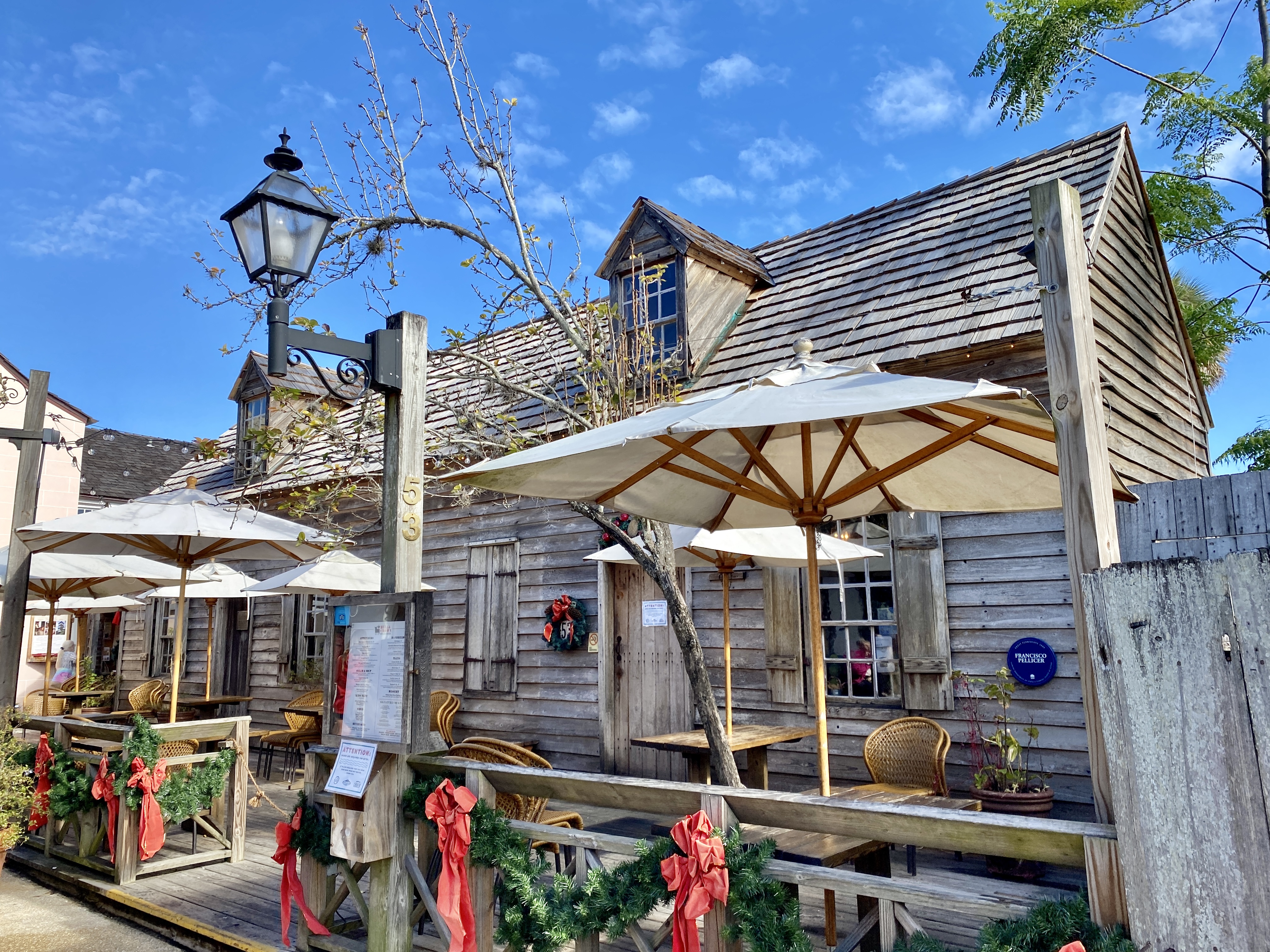
He later received a Spanish land grant and established his homestead along the creek's banks around 1800, lending the waterway his name. He lived until 1826. Driving the Heritage Crossroads today, you pass through land that still reflects the community Pellicer fought to keep intact - their descendants, their churches, their family names are all present in the corridor's built history. The creek is the physical address of that story.
Pellicer's homestead was late in the sequence. The Timucua people occupied the Pellicer Creek area for centuries before the Spanish arrived, predating every European chapter of the corridor's history. They were skilled estuarine people who read the tidal marsh not as an obstacle but as a food system and a travel route. The Spanish arrived, then the British, then the Spanish again, then the Americans. Each administration reorganized the land, issued grants, and renamed things. The creek continued cycling nutrients through the estuary, draining the interior watershed into the Matanzas River, hosting the same wood storks and great blue herons that work the shallows today. The Heritage Crossroads places that continuity inside a driving narrative; Pellicer Creek makes it tangible.
Outstanding Florida Water: What the Designations Actually Mean
Pellicer Creek Aquatic Preserve was formally designated by the Florida Legislature in 1970. It covers 505 acres of submerged creek bottom. Surrounding it, the Pellicer Creek Conservation Area managed by the St. Johns River Water Management District adds 2,535 acres of upland and marsh - a buffer that keeps the development pressure of U.S. 1 from reaching the water's edge.
On March 1, 1979, the creek received Outstanding Florida Water status - the strictest water-quality tier in Florida law. That classification matters in practical terms. It prohibits any new discharge that would reduce the creek's existing water quality. The legal floor on water quality is locked at the creek's condition at the time of designation. No industrial outfall, no stormwater pipe discharging below that baseline.
Pellicer Creek carries the strictest water-quality protection Florida law allows - which is the direct reason the waterway looks today much as Francisco Pellicer left it in 1826.
A second layer comes from the creek's position within the Guana Tolomato Matanzas National Estuarine Research Reserve, one of the largest undeveloped estuarine systems on the U.S. East Coast. The GTM Reserve is the reason the surrounding watershed remains so intact. Federal research reserve designation restricts development within the estuarine system and funds ongoing monitoring of water quality, wildlife populations, and marsh health. No paddling guide currently connects these two facts, but together the aquatic preserve, the conservation area, and the GTM Reserve form an interlocking set of protections that no single designation could provide alone.
- Aquatic preserve (state): Protects the 505 acres of submerged creek bottom; enforces no-discharge rules
- Outstanding Florida Water designation: Sets a hard floor on water quality; blocks any degradation below the 1979 baseline
- Conservation area (SJRWMD): Buffers 2,535 acres of upland and marsh from surrounding development
- GTM National Estuarine Research Reserve (federal): Protects the larger estuarine system that makes the creek's ecology function; funds long-term monitoring
The Paddling Trail in Detail
Two Launch Points, Three Route Options
The Florida-designated State Canoe Trail runs 3.5 miles between Faver-Dykes State Park and Princess Place Preserve. Faver-Dykes is the primary launch: the park has a dedicated kayak and canoe ramp, a small motorboat ramp, and restrooms on site. Princess Place Preserve offers a secondary launch with access to its historic lodge and grounds, but no restroom at the water's edge. Your route choice depends on whether you are running a shuttle or returning to your starting point.
| Route | Distance | Shuttle Required | Water Character |
|---|---|---|---|
| Faver-Dykes to Hulette Creek junction (one-way, then back) | 2.9 miles one-way | No - turnaround | Brackish tidal marsh, transitioning to fresher water |
| Faver-Dykes to Princess Place (point-to-point) | 3.5 miles | Yes - two cars | Full tidal near launch; sheltered upper creek near finish |
| Faver-Dykes to headwaters and return | 6.5 miles round trip | No | Open tidal flats near mouth; increasingly fresh and shaded inland |
How the Water Changes as You Move Inland
Salt marsh cordgrass - Spartina alterniflora - dominates both banks near the Faver-Dykes launch. Tidal flushing is strongest here, continuously cycling nutrients into the estuary. Bird activity reflects that richness. As you paddle west, the creek narrows and the marsh gives way to freshwater vegetation. The Hulette Creek tributary junction at 2.9 miles is where many first-timers turn around. Paddlers who continue find the upper section quieter, shadier in summer, and noticeably less exposed to wind. The full 6.5-mile round trip to the headwaters rewards the extra distance.
The creek empties into the Matanzas River - part of the Atlantic Intracoastal Waterway - about 2.5 miles south of Fort Matanzas National Monument. The creek mouth opens onto Pellicer Flats, the prime wildlife-watching area on the trail. There is no commercial development above Faver-Dykes and no motorboat traffic on the designated section - a direct contrast to the busy Intracoastal corridor less than a mile to the east.
Reading the Tides and Wind
Water depth along the paddling section ranges from 2 to 6 feet, with the shallower readings on the open flats near the mouth and in side channels. Tidal fluctuation runs 1 to 2 feet. That swing governs your whole day. A falling tide on the lower creek means fighting a current on the return; an incoming tide on the upper section moves you inland with little effort but can make the return feel labored. Most experienced paddlers launch within two hours of low tide, letting the incoming current assist them inland, then riding a neutral or early-ebb current back out.
Wind is the factor paddlers underestimate most. The lower creek and Pellicer Flats are open enough that a northeast wind - common from November through March - creates chop that slows a loaded kayak considerably. The section above Faver-Dykes is well-sheltered by the marsh vegetation on both sides, but the mouth area can be uncomfortable in sustained winds above 15 knots. Check both the tide table and the National Weather Service marine forecast for the St. Augustine area before you commit to the lower section.
Wildlife of Pellicer Creek
More than 100 bird species use the creek corridor during migration season. Resident wildlife includes alligators, river otters, white-tailed deer, and bobcats in the adjacent conservation area uplands, making this one of the few paddles in northeast Florida where a canoeist can realistically see all four in a single morning. Pellicer Flats at the creek mouth is the specific hotspot for dolphins and manatees - two species that no competitor guide has identified by location on this trail.
- Fall and winter (October through February): Peak migration. Roseate spoonbills, wood storks, great blue herons, tricolored herons, snowy and great egrets work the tidal margins. Manatees follow warm-water gradients upstream from the Matanzas River. Best season for bird volume and overall wildlife diversity.
- Spring (March through May): Nesting season. Osprey on platform nests, river otters frequently visible in pairs along the upper creek banks, vegetation at its most active. Dolphin presence at the flats is reliable on incoming tides.
- Summer (June through September): Heat and insects increase; launch before 7 a.m. to catch the morning activity. Alligators are at peak activity - adults bask on banks in the early morning. Manatees move well upstream during warm months.
- Year-round: Bottlenose dolphins at Pellicer Flats, alligators throughout the creek system, ospreys, and great blue herons at every water level and season.
Dolphins at Pellicer Flats work the incoming tide to push baitfish onto the shallows. The best viewing window is a rising tide in the first two hours after low water. Both dolphins and manatees are federally protected - observe from a distance and do not approach or position your boat to block their travel path.

Combining the Creek with the Heritage Crossroads Corridor
The Heritage Crossroads highway gives Pellicer Creek a context that no standalone trail listing provides. The creek sits between two preserved properties that extend the day onto land, and Fort Matanzas is close enough to connect the waterway to the larger colonial history of the region.
A half-day: launch from Faver-Dykes, paddle to the Hulette Creek junction and return, then walk one of the park's hiking trails through the pine flatwoods. Faver-Dykes is genuinely under-visited, and the upland trails offer a different cross-section of the same ecosystem you just paddled through.
A full-day: use Princess Place Preserve as the paddle's destination. Princess Place holds the oldest intact structure in Flagler County - the lodge dates to the late 1880s and sits on a bluff above the creek. After the 3.5-mile point-to-point, tour the lodge and the surrounding preserve on foot. Flagler County manages Princess Place; check the Flagler County Parks website for current lodge hours and access conditions. Fort Matanzas National Monument, operated by the National Park Service, sits about 2.5 miles north on the Matanzas River by water - or a short drive by road - and puts the military history of the Spanish colonial period directly next to the Minorcan community story that Francisco Pellicer carried from New Smyrna.
Practical Planning
Shuttle Logistics for the Point-to-Point Run
The 3.5-mile one-way run is more satisfying than a round trip for most paddlers, but it requires two cars. Here is the sequence:
- Drive both vehicles to Princess Place Preserve. Confirm the takeout ramp is accessible and note the exact landing location.
- Leave one vehicle at Princess Place.
- Drive the second vehicle to Faver-Dykes State Park and unload boats and gear at the kayak launch.
- Pay the park entry fee at Faver-Dykes - check floridastateparks.org for the current amount, as it is adjusted periodically.
- Launch from Faver-Dykes and paddle the 3.5 miles to Princess Place.
- After takeout, drive one car back to Faver-Dykes to retrieve the second vehicle.
Gear and Leave No Trace
- Kayak or canoe; sit-on-top kayaks handle the lower tidal section well
- Personal flotation device - legally required in Florida for all paddlers
- NOAA tide predictions for St. Augustine inlet - print or download before you leave
- Sun protection: hat, UV shirt, sunscreen - the lower marsh has no overhead shade
- Insect repellent, essential from April through October
- At least two liters of water per paddler; no potable water at Princess Place launch
- Dry bag for keys, electronics, and anything that cannot get wet
The best paddling months are November through March: moderate temperatures, manageable insects, and peak bird activity. Summer is possible but demands an early start. Entry fees apply at Faver-Dykes; check floridastateparks.org for current pricing. For Princess Place access conditions and any seasonal closures, check the Flagler County Parks website before you go.
Frequently Asked Questions
Do I need a permit to paddle Pellicer Creek?
No permit is required to paddle the creek itself. You do pay an entry fee to access Faver-Dykes State Park as a launch point; check floridastateparks.org for the current rate. If you launch from Princess Place Preserve, confirm access conditions with Flagler County Parks, as hours and policies can change by season.
Can I paddle from the creek mouth out to Fort Matanzas by water?
Technically yes - Pellicer Creek empties into the Matanzas River about 2.5 miles south of Fort Matanzas, and the river connects them. But the Matanzas River at that junction carries Intracoastal Waterway boat traffic, which makes it a very different experience from the sheltered creek. That section is suitable for confident paddlers in calm conditions, not for beginners or anyone on their first visit to the creek.
Is Pellicer Creek suitable for beginners?
The upper section above Faver-Dykes is well-suited to beginners on calm days - sheltered banks, no motorboat traffic, and forgiving depth. The lower section near Pellicer Flats is more demanding: wind and tidal current combine on open water, and the flats can strand a loaded boat on the ebb. First-time paddlers should choose a calm day, consult a tide chart, and plan a turnaround point before reaching the open flats.
Where does Francisco Pellicer's story connect to the rest of the Heritage Crossroads route?
St. Augustine, at the northern end of the Heritage Crossroads corridor, holds the material record of the Minorcan community Pellicer helped preserve - their churches, cemeteries, and neighborhood history are visible in the Old City. A full corridor itinerary can begin with that urban history in St. Augustine and follow the highway south to the creek that carries his name, linking the community story to the land grant that ended it.
Why is there no motorboat traffic on the creek above Faver-Dykes?
It is primarily a practical consequence of the creek's depth and character above the park, combined with the Outstanding Florida Water and aquatic preserve protections that discourage new commercial use of the waterway. The designation does not formally ban all motorboat use, but the shallow tidal flats and narrow upper channel make the section impractical for most motorized craft, and the legal protections add a strong disincentive to any commercial development that might change that condition.